Golden Rocks: The Geology and Mining History of Golden, Colorado

Have you ever wondered how the landscape around the City of Golden came to be? Why are North and South Table Mountains so flat? What’s up with all those rock fins on the back-nine at Fossil Trace Golf Course? What are those white stripes along the sharp ridge west of State Hwy-93 to Boulder? Were there ever any dinosaurs in Golden? Where did those round rocks in the Armory Building come from? Did anyone ever find any gold in Golden? Did you know that Golden was a mining town from 1870 through the 1950s? And, that most of the public open space in and around Golden has its roots in mining?

This book answers these questions and more by unraveling the tapestry of the Golden landscape. You will discover the origins of what you are walking or cycling by, driving across, golfing over, or simply just seeing every day when you walk out of your home. You will learn the story behind Golden’s good drinking water. You will learn how Golden’s early settlers used their local rock materials to build Golden and Denver, a legacy that still provokes controversy.

Anderson, Donna S., and Paul B. Haseman. Golden Rocks: The Geology and Mining History of Golden, Colorado. Golden, CO: Anderson-Haseman, 2021.

Here’s a marvelous publication from the talented and insightful Donna Anderson and Paul Haseman. Their passion for geology and for communicating the fascinating and often surprising facts about Golden and its geologic history show through every page of this informative book.

Anderson-Haseman-2021-Golden-Rocks

Download your free PDF copy. Enjoy! It’s a great read, especially if you are one of the lucky folks who live in Golden where you can simply look around and experience the geology firsthand. Or, if you are a visitor, it will add immeasurably to your appreciation of our town as you also visit the other attractions in the area (including the Museum of Earth Science on the Colorado School of Mines campus).

Thanks again to the authors for both their generosity in making this publication freely available and their dedication to public science education!

Case Study: Denver – 9 August 1967

Major magnitude 5.3 earthquake shock in Denver

On 9 August 1967, Denver experienced an earthquake that caught the city’s residents by surprise. The tremor, which registered 5.3 on the Richter scale, was particularly notable as it occurred in a region not typically associated with significant seismic activity. What made this earthquake even more remarkable was its eventual connection to human activity—specifically, the disposal of wastewater at the Rocky Mountain Arsenal, a chemical weapons manufacturing facility northeast of the city. This event would later become a classic case study in induced seismicity, where human actions trigger earthquakes, and it helped establish important precedents for understanding the relationship between fluid injection into the ground and subsequent seismic events.

One of the strongest and most economically damaging earthquakes to affect the Denver area in the 1960s occurred on August 9, 1967 around 6:30 AM, awakening and frightening thousands of people. This magnitude 5.3 earthquake, centered near Commerce City, caused more than eight million dollars (2022 dollars) in damage in Denver and the northern suburbs.

Felt reports and intensity ratings were described by von Hake and Cloud (1984). Intensity VII damage was reported in Northglenn, where plate glass windows broke, many walls, ceilings, foundations, and concrete floors cracked, and several businesses sustained damage due to fallen merchandise. One liquor store had estimated damage at USD $90,000 to $175,000 (2022 dollars).

Intensity VI damage was reported in 28 locations, many of which suffered considerable cracked plaster and mortar, broken windows, damaged foundations and chimneys, and damage to household goods. The earthquake was felt as far as Sterling to the northeast and Pueblo, Colorado to the south, as well as north to Laramie, Wyoming.

Based on the isoseismal map, the estimated felt area was about 20,000 mi2 (50,000 km2). Von Hake and Cloud (1984) proposed a size of 15,000 mi2 (39,000 km2), while Hadsell (1968) indicated it was felt over 45,000 mi2 (117,000 km2). Docekal (1970) reported a felt area of 20,000 mi2 (52,000 km2). A magnitude of Mb 5.3 was reported for this earthquake by von Hake and Cloud (1969). Nuttli and others (1979) calculated an Mb of 4.9 and ms of 4.4. Herrmann and others (1981) suggested a focal depth of 1.9 mi (3 km) for this event. The overall felt area is prominently elongated in directions parallel and perpendicular to the (north-south oriented Front Range) mountain front. The intensity V and VI contours are also oriented in an elongate pattern perpendicular to the mountain front.

Aerial view of the Rocky Mountain Arsenal, south plant, 1970. Photo credit: US Library of Congress.

This substantial earthquake, the largest of a long series, is believed to have been triggered by the deep injection of chemically-charged wastewater into a borehole drilled to a depth of 12,045 ft (3671 m) at the Rocky Mountain Arsenal in 1961. It was followed by an earthquake of magnitude 5.2 on November 27, 1967. In total, between 1962 and 1967 the U.S. Geological Survey (USGS) recorded over 1,500 earthquakes in the area. The Arsenal was a large chemical weapons-manufacturing facility run by the U.S. Army in Commerce City. Wastewater injection at the site stopped in 1966 and the entire facility closed in 1992. Much of the area is now a national wildlife refuge.


Citations NOTE: The ON-002 Earthquake Reference Collection which includes most of the following references, and 700 more—is available to researchers—see instructions on that page to access the collection.

Bardwell, George E. “Some Statistical Features of the Relationship between Rocky Mountain Arsenal Waste Disposal and Frequency of Earthquakes.” The Mountain Geologist 3, no. 1 (1966): 37–42.
more “Case Study: Denver – 9 August 1967”

DMNS Meteorite Collection

Colleagues at the Denver Museum of Nature and Science, led by Dr. James Hagadorn, the Curator of Geology at the museum, released a fine 36-page publication The Meteorite Collection of the Denver Museum of Nature & Science. It contains a fascinating history of the collection with back stories on some of the many specimens, along with a reference list and a full catalog of the collection. It’s available as a free pdf download, but the paper copy is well worth the $3.16 price-point (how do they manage to sell it for so little??). It’s the next best thing to a visit to the DMNS … when in Denver!

RT-0046503-dmns-sr-17-meteorites

Hagadorn, James W., Emerald J. Spindler, Ada K. Bowles, and Nicole M. Neu-Yagle. Denver Museum of Nature and Science Report 17: The Meteorite Collection. Vol. December 11, 2019. Denver Museum of Nature and Science Report SR-17. Denver, CO: The Denver Museum of Nature and Science, 2019.

Following is a selection of meteorite specimens in the Denver Museum of Nature and Science collection:

Broken piece of Cañon City meteorite (DMNH EGT.165), fell through the roof of a garage in Cañon City, Colorado, 1973. Exhibits black fusion crust surrounding an interior dominated by lighter-colored minerals. Photo credit: R. Wicker for the Denver Museum of Nature and Science.

more “DMNS Meteorite Collection”

Case Study: Big Thompson Flood

On July 31, 1976, a powerful thunderstorm over Colorado’s Big Thompson Canyon unleashed a deluge that became one of the state’s most catastrophic natural disasters. Known as the Big Thompson Flood, this event claimed 144 lives, caused significant damage to infrastructure, and left a lasting impact on both the physical and social landscapes. This flood serves as a case study of the interplay between geologic conditions, meteorology, and human activity in a high-risk environment.

Front page of the Rocky Mountain News following the catastrophic flood in Big Thompson Canyon in August of 1976.

The Meteorological Trigger

The Big Thompson Flood was caused by an intense, stationary thunderstorm that dropped more than 12 inches of rain in just four hours over the steep canyon. The localized nature of the storm, combined with its high rainfall intensity, overwhelmed the Big Thompson River’s drainage system. This type of weather event is not uncommon in Colorado, where summer thunderstorms can deliver large amounts of precipitation over short periods. The semi-arid climate, combined with the region’s high topographic relief, creates conditions that are particularly conducive to flash flooding.

Thunderstorms of this magnitude occur when warm, moist air is forced upward by the mountainous terrain, cooling and condensing into heavy rainfall. In the case of the Big Thompson Flood, the storm’s stationary position ensured that all the precipitation fell within a confined area, greatly intensifying the flood’s impact.

Geological Setting of Big Thompson Canyon

Big Thompson Canyon, located in the Rocky Mountains of northern Colorado, is a steep and narrow valley carved over millions of years by the Big Thompson River. The canyon’s geology is dominated by granitic bedrock interspersed with loose sediments and colluvium, materials that are easily mobilized during heavy rainfall. The steep canyon walls and limited floodplain amplify the destructive potential of flash floods, as water rapidly accumulates and accelerates downhill.

House precariously undercut by lateral scour on the Big Thompson River a quarter of a mile below Glen Comfort, Larimer County, August 1976. Photo credit: Ralph Shroba.

One of the key factors in the severity of the 1976 flood was the canyon’s geomorphology. The steep gradient of the river increased the velocity of the floodwaters, allowing them to carry massive amounts of sediment, debris, and rock. This debris flow not only caused direct damage but also increased the erosive power of the water, undercutting slopes and triggering landslides that further contributed to the destruction.

more “Case Study: Big Thompson Flood”

Case Study: mine subsidence, CSM

For decades, the west side of the Colorado School of Mines (CSM) main campus had subsidence issues related to historical mining activities. At one point, in the 1990s, one of the married student housing units in that area was so badly damaged that it was condemned. In the early 2000s, after the school converted the subsidence-prone area into intramural-athletic (IM) fields, ongoing subsidence-related issues were still being reported.

Clay mining in Colorado dates back to the mid-1800s and Golden was a particularly good location for clay found in the Laramie Formation. This clay has been used for a variety of industrial purposes over the years including construction (bricks, structural tiles, sewer pipes), terracotta, refractory clays, and earthenware. The mining of kaolinitic claystones in what was later to become the western area of the Mines campus left backfilled/collapsed mine workings and the possible presence of underground void spaces. To complicate matters, that same area was also the site of coal mining in the 1880s and 1890s. In particular, the Pittsburg Coal Mine entry shaft may have been located in the vicinity of one of the observed subsidence features. This mine reportedly operated between 1876 and 1880, but is un-recorded by the State. The mining operations were thought to be on three levels at depths of 100, 150, and 225 feet running parallel to the mountains.

The condition of the Rockwell clay mine immediately south of the CSM campus and 19th Street along US 6 in 1977 before more recent reclamation as a golf course. Note the near-vertical dip on the up-turned sedimentary layers. The green area to the top left is part of the IM field where the subsidence occurred in the 2000s. Photo credit: Colorado Geological Survey.
more “Case Study: mine subsidence, CSM”

Case Study: Rockfall – Manitou Springs

[ED: This brief report from 1995 was written by Jon White, (Senior Engineering Geologist, emeritus). It looks at a specific rockfall situation in the central Front Range town of Manitou Springs. There are hundreds of similar instances like this where gravity rules in mountainous terrain. Geotechnical solutions are of some help in the long-term scale of the hazards, but are extremely expensive to implement. Development pressures that are affecting building in areas threatened by natural disasters—of small and large scale—continue apace in the US West.]

Manitou Springs occupies a narrow valley where Fountain Creek emerges from the foothills northeast of Pikes Peak and west of Colorado Springs. The valley slopes are composed of interbedded resistant sandstone and conglomerates (i.e., gravelly sandstone), and weaker mudstones and shale. The outcropping sandstone is most prevalent on the steeper slopes on the north side of the valley.

During the wet spring of 1995, rockfall and landslide incidents increased throughout Colorado, some resulting in fatalities. In Manitou Springs, a fortunate set of circumstances occurred before the Memorial Day holiday weekend when local residents observed the movements of a large, dangerous block of rock before it actually could fall. The observation set into motion an emergency declaration by the town, resulting in a compulsory evacuation of homes located below the rocky slope, the closing of the road in the area, and an immediate rock stabilization project. During this emergency situation, the Colorado Geological Survey was asked to provide expert assistance to help stabilize the rock. The emergency evacuation decree remained in effect until the rock was stabilized and the area subsequently declared safe.

The ledge of jointed sandstone along with several large displaced blocks is seen at the center of the image. Photo credit Jon White.
more “Case Study: Rockfall – Manitou Springs”

Case Study: Lykins Formation

Small but significant areas of Colorado are underlain by bedrock that is composed of evaporative minerals. These are salts and sulfates that precipitate out of salt-concentrated surface waters. In the geologic past these minerals were deposited in shallow seas within closed or restricted basins where the seawater evaporation rate exceeded the replenishing supply. Current environments that are similar include the Great Salt Lake in Utah and the Dead Sea in the Middle East. These minerals are predominantly anhydrite (CaSO4) and halite (rock salt – NaCl) at depth, and gypsum (CaSO4*H2O) near the surface. Over geologic time, the evaporative minerals filled the sea basins and were subsequently buried beneath younger sediments. Through burial diagenesis, these deposits become evaporite bedrock. After the Rocky Mountains rose, millions of years of subsequent erosion and downcutting of rivers has now exposed some of these evaporite rocks at the surface.

Two characteristics of evaporite bedrock are important. One is that evaporite minerals can flow, like a hot plastic, under certain pressures and temperatures. The second, and most important to land use and development, is that evaporite minerals dissolve in the presence of fresh water. It is this dissolution of the rock that creates caverns, open fissures, streams outletting from bedrock, breccia pipes, subsidence sags and depressions, and sinkholes. These landforms are described collectively as karst morphology. Karst morphology originally referred to limestone areas known for characteristic closed depressions, sinkholes, caverns, and subterranean drainage. Evaporite karst comprises similar morphology where these features develop as a result of dissolution of the evaporite minerals.

One example of evaporative bedrock in Colorado is the Permo-Triassic Lykins Formation redbeds that contain massive gypsum deposits, up to 50 feet (15 m) thick. Dissolution of those beds and some of the thin algal limestone within the unit is responsible for many sinkholes and ground subsidence features inside the main Dakota Sandstone hogback that marks the boundary of the Eastern Plains and the Front Range.

Munroe Quarry near Livermore, Colorado in Larimer County, which produces gypsum from the Permo-Triassic Lykins Formation. Photo credit: Colorado Geological Survey." width="600" height="395" /></a> Munroe Quarry near Livermore, Colorado in Larimer County, which produced gypsum from the Permo-Triassic Lykins Formation.
Munroe Quarry near Livermore, Colorado in Larimer County, which produces gypsum from the Permo-Triassic Lykins Formation. Photo credit: Colorado Geological Survey.

more “Case Study: Lykins Formation”

flash-flooding

On the afternoon of 27 August 2024, the area including Upper Sand Canyon, a relatively small drainage in Dinosaur National Monument, experienced a major precipitation event. The fifteen mile Echo Park access road, in part, runs the full length—about three miles—down that canyon, much of it in the fluvial hazard zone. Long stretches of the road were completely washed out, and it was only the heroic efforts of the guy re-grading it that re-opened access to Echo Park some days later. I recently made it back up to Dinosaur for a short sojourn after an interminable and blurry five-year absence.

Earlier bush-walks along the dry washes in the area, the curious effects of flash-flooding as well as other, slower, changes are noted. I’ve come across dried-mud-caked trees in Upper Pool Creek Canyon more than 20 feet higher than the dry creek bed, yikes! And in some areas of Hells Canyon, boulders the size of small cars are seen piled up and ground together in violent proximity.

With the 27 August incident in mind I did a long bush-walk along the east-west axis of the Ruple Point-Red Rock Anticline that forms the Weber Sandstone hogbacks running perpendicular to Upper Sand Canyon.

Looking upstream into the scoured wash of Upper Sand Canyon, Dinosaur National Monument, Colorado, October ©2024 hopkins/neoscenes.

Looking downstream, close to the egress from Upper Sand Canyon where the force of the water pushed a large juniper tree right over. Never underestimate the force of moving water! Dinosaur National Monument, Colorado, October ©2024 hopkins/neoscenes.
more “flash-flooding”

Case Study: The Big One

It has been well over a century since “The Big One”: Colorado’s largest historic earthquake that occurred on 7 November 1882 – Magnitude 6.6.

On Tuesday, 7 November 1882 at about 6:30 p.m. local Denver time, a moderately strong earthquake shook much of Colorado, along with parts of southern Wyoming and northeastern Utah. The following quote from the Rocky Mountain News gives an indication of the shaking in Denver, 60 miles (100 km) from the approximate epicenter.

A general stampede was caused among the employees of The News office, especially in the editorial rooms. The editors and reporters were seated engaged at work when the floors of the editorial rooms began to tremble violently. … for a short time it appeared as if the building was about to tumble in.

— Rocky Mountain News, November 8, 1882

The shaking was so great in Denver that it broke the electrical generators loose from their mounts and knocked out power. The earthquake was apparently felt as far east as Salina, Kansas and perhaps even in Plattsmouth, Nebraska (Rockwood, 1883; Oaks and Kirkham, 1986); and as far west as Salt Lake City.

The earthquake Tuesday evening not only created a sensation but did some damage. It was observed by a few pedestrians who were not particularly interested in the election returns that the electric lights were suddenly extinguished at half past 6. Among the observers was Superintendent Runkle. He went immediately to the electric light building at the foot of Twenty-first street and found that an accident had occurred to the machinery. From the driving pulley of engine there is a connection of shafting five inches in diameter and divided into sections of 12 feet. These sections are connected by large iron bolt screws nearly an inch in diameter. At the instant of the earthquake shock one of those bolts was snapped in twain and the other bent out of shape. The whole machinery was thrown out of gear, and it became necessary to stop the machinery at once. Mr. Runkle is of the opinion that the upheaval which caused the earthquake ran east and west and centered about his establishment and the residency of Mr. Birke Cornforth. It was ascertained yesterday that the shock was so severe in the northern portion of the city that many families ran from their houses.

— The Denver Tribune, November 8, 1882

An aftershock followed on the morning of November 8 and was felt in Denver, Boulder, Greeley, Laramie, and near Meeker. The main event was the largest earthquake to occur in the Colorado region during the historical period (1867-present) and has been the object of considerable study by numerous researchers. Heck (1928) reported the felt area—that is, the total area where credible reports of ‘felt’ earthquake movement and its direct effects were made—as 11,000 mi2 (28,000 km2). Hadsell (1968), as part of the investigation of the earthquakes at the Rocky Mountain Arsenal, conducted the first extensive evaluation of this event. Hadsell concluded the earthquake may have been centered north of Denver and east of Boulder, had maximum intensity of VII, and was ML (local magnitude scale) 5.0 ± 0.6 based on the maximum observed intensity or ML 6.7 ± 0.6 based on its circular felt area of just under 460,000 mi2 (1,200,000 km2).
more “Case Study: The Big One”

Case Study: detrital zircon

[ED: I decided—in terms of public service and of documenting the occasional editorial work I did—to re-work and re-publish some of the public domain blog postings I authored when at the Colorado Geological Survey. This one addresses an important analytical tool used to date and characterize geologic formations that may be several billion years old.]

Detrital zircon (DZ), a tiny but invaluable occurrence of the mineral zircon, zirconium orthosilicate, plays a pivotal role in unraveling the geological history of many complex regions around the world. These minuscule crystals, often no larger than a grain of sand, hold within them a treasure trove of information about the Earth’s past. Detrital zircons are primarily found in sedimentary rocks, and their age can be determined through radiometric dating techniques, an analytic method barely a century old that arose out of the discovery of radioactivity. This laboratory process is called detrital zircon geochronology. In the case of the Front Range of Colorado, these DZs provide crucial insight into the formation and evolution of the Rocky Mountains and the geological events that have shaped the state over billions of years.

Detrital zircon grains of an igneous rock as seen through an incident light microscope. Photo credit: Martin Lindner. From: Költringer, Chiara. “Detrital Zircons: How the Age of a Resistant Mineral Can Help to Reconstruct the Climate of the Past.” Science. EGU Blogs: Climate: Past, Present & Future (blog), May 20, 2021.
Detrital zircon grains of an igneous rock as seen through an incident light microscope. Photo credit: Martin Lindner. (Költringer, 2021).
more “Case Study: detrital zircon”

any landscape …

Chicago Lake, Colorado, from Hayden, Ferdinand Vandeveer. “Annual Report of the United States Geological and Geographical Survey of the Territories: Embracing Colorado and Parts of Adjacent Territories; Being a Report of Progress of the Exploration for the Year 1874.” Washington, DC: US Geological Survey, 1876.
Chicago Lake, Colorado, from Hayden’s “Annual Report of the United States Geological and Geographical Survey of the Territories: Embracing Colorado and Parts of Adjacent Territories; Being a Report of Progress of the Exploration for the Year 1874.” Washington, DC: US Geological Survey, 1876.

Any landscape is so dense with evidence and so complex and cryptic that we can never be assured that we have read it all or read it aright. The landscape lies all around us, ever accessible and inexhaustible. Anyone can look, but we all need to see that it is at once a panorama, a composition, a palimpsest, a microcosm; that in every prospect there can be more and more that meets the eye.

Meinig, Donald W., and John Brinckerhoff Jackson, eds. The Interpretation of Ordinary Landscapes: Geographical Essays. New York, NY: Oxford University Press, 1979.

Meinig’s allusion to holistic natural systems is quoted in an essay and exhibition on the historical “Drawings of the Great Colorado Survey”:

Huber, Thomas P. Hayden’s Landscapes Revisited: The Drawings of the Great Colorado Survey. Boulder, CO: University Press of Colorado, 2016.

James Miller‘s concept of “living systems” emphasizes that all such systems—from cells to landscapes to societies—share common scale-independent patterns of organization and processes as well as divergent features. As initially articulated in an editorial by Miller in 1956 in the then-new journal Behavorial Science:

Our present thinking-which may alter with time-is that a general theory will deal with structural and behavioral properties of systems. The diversity of systems is great. The molecule, the cell, the organ, the individual, the group, the society are all examples of systems. Besides differing in the level of organization, systems differ in many other crucial respects. They may he living, nonliving, or mixed; material or conceptual; and so forth.

Miller, James Grier. “Editorial.” Behavioral Science 1, no. 1 (January 17, 2007): 1–5. https://doi.org/10.1002/bs.3830010102.

In the context of landscapes, this approach aligns with systems thinking by focusing on how ecosystems, organisms, and human activities interact within larger networks, and are themselves comprised of smaller and smaller networks. A landscape may be seen as a living system with a complex of nested subsystems, where elements like nutrient cycles, energy flows, and information exchanges are interconnected. These interactions contribute to emergent properties and systemic behaviors, underscoring the need to consider the whole landscape when analyzing environmental changes and implementing management strategies. Augmenting or supplanting those more empirical methods, we believe that artistic, creative, imaginative, embodied, and other refined sensory-based processes can very effectively address and engage not only the astounding complexity, but the raw and inspiring beauty of these systems. Key to what may be a singular holistic ‘understanding’ of a landscape is focused and sustained observation that is aware of the scalar similarities and differences.


The original Hayden report from 1876:

Hayden recognized the profound value of William Henry Holmes‘ drawings, though he did not formally recognize the other artists who produced documentary drawings on the expeditions, He reserved most of his praise for William Henry Jackson, the photographer who documented so expansively the landscapes of the American West setting the creative precedent for the likes of Ansel Adams, Richard Misrach, Robert Adams, Willy Sutton, and the many others who followed.

NASA Earth Observatory

One of my favorite online feeds is from the NASA Earth Observatory along with their Image of the Day. After catching a recent article on the San Luis Valley, I thought that subscribers might be interested in some of the incredible material that NASA offers on a daily basis. This includes front-line data used in climate research.


“The Earth Observatory’s mission is to share with the public the images, stories, and discoveries about the environment, Earth systems, and climate that emerge from NASA research, including its satellite missions, in-the-field research, and models.”


An expansive view of most of Colorado looking from the south-south-west from the International Space Station (ISS). Photo credit: NASA.

The Details

Earth Observatory GIS browserA global map index of thousands of images—one can go direct to Colorado and see more than seventy feature articles covering natural hazards, geology, atmospheric science, and other subjects.

Global MapsA wide range of maps compiled from satellite data.

Feature ArticlesCovering many important topics such as remote sensing, atmosphere, snow & ice, water, and life.

NASA EO blogsIncredibly informative nuggets of research into the natural world, including several topical blogs:

Earth MattersIncludes in-depth reports on everything from Astronaut Photography to Where on Earth?

Notes From the FieldStories about how NASA conducts its scientific work and the technologies that make it all possible.

EO KidsWritten for audiences aged 9 to 14, it has many educational features.

Climate Q&AIncludes in-depth answers to common questions about the global climate.

You may also subscribe to different email newsletters and/or RSS feeds

Earth Explorations vlog/podcasts

Dr. Christian Shorey—Teaching Professor of Environmental Science and Climatology in the Geology and Geological Engineering Department at Mines—jumped into a social media experiment with the Earth and Environmental Systems Podcast in 2008. After producing more that 60 audio episodes he segued to the Earth Explorations vlog on Youtube which includes more than one hundred video episodes!

Red Rocks Park on the west side of Denver, Colorado. The red strata of the Pennsylvanian/Permian Fountain formation rests on Precambrian metamorphic rocks. Photo credit: Vince Matthews.

Originally designed to accompany Dr. Shorey’s 2008 SYGN 101 Earth and Environmental Systems Science course, both the podcasts and vlogs provide fast-paced and informative explorations of a wide range of geologically- and environmentally-oriented topics. Among these: geohazards, climate change; geography; economics; anthropology; history; and biology. The vlog includes segments on mapping, mineralogy, age-dating, plate tectonics, as well as field-trip material to some of the prime geological features in the Golden, Colorado area: Red Rocks, North Table Mountain, and around the Mines campus. The vlog also demonstrates the effective use of drone photography in geological field education. Check it out!

Case Study: NARD

[ED: I decided to re-work and re-publish some of the public-domain articles that I compiled and wrote for the CGS as they are no longer updating the widely-read >RockTalk<  blog that I established for them back in 2016.

Public interest regarding human-caused water pollution from abandoned mines remains high following the Gold King Mine event in 2015. Complicating the overall water-quality issue is the presence of natural pollution sources that affect the baseline condition of many watersheds across the state. These areas are often accompanied by obvious surface indicators as depicted in the photos.]

Are so-called pristine mountain waters always clean and pure? Can streams unaffected by human activities and livestock influences be unfit for human consumption, or for aquatic life? The existence of natural acid rock drainage (NARD) suggests a “no” to the former, and a “yes” to the latter question.

But what exactly is NARD? 

more “Case Study: NARD”

field work

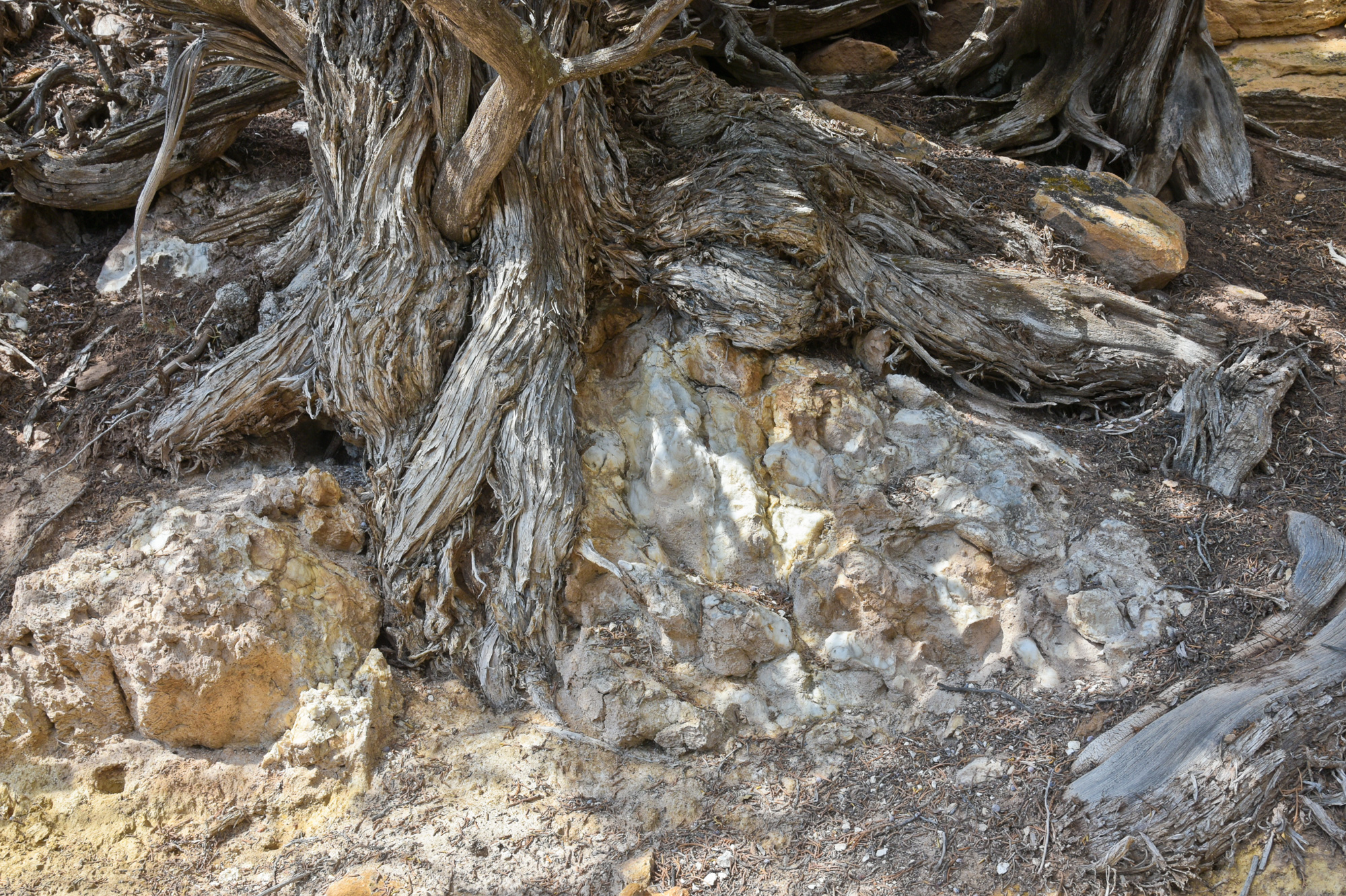
Massive gypsum deposit (white)—sheltered from dissolution by a shag-bark juniper tree—in the Mesozoic Entrada sandstone immediately above the Precambrian-Mesozoic unconformity at the Black Canyon of the Gunnison National Park, Colorado, August ©2022 hopkins/neoscenes.

field work

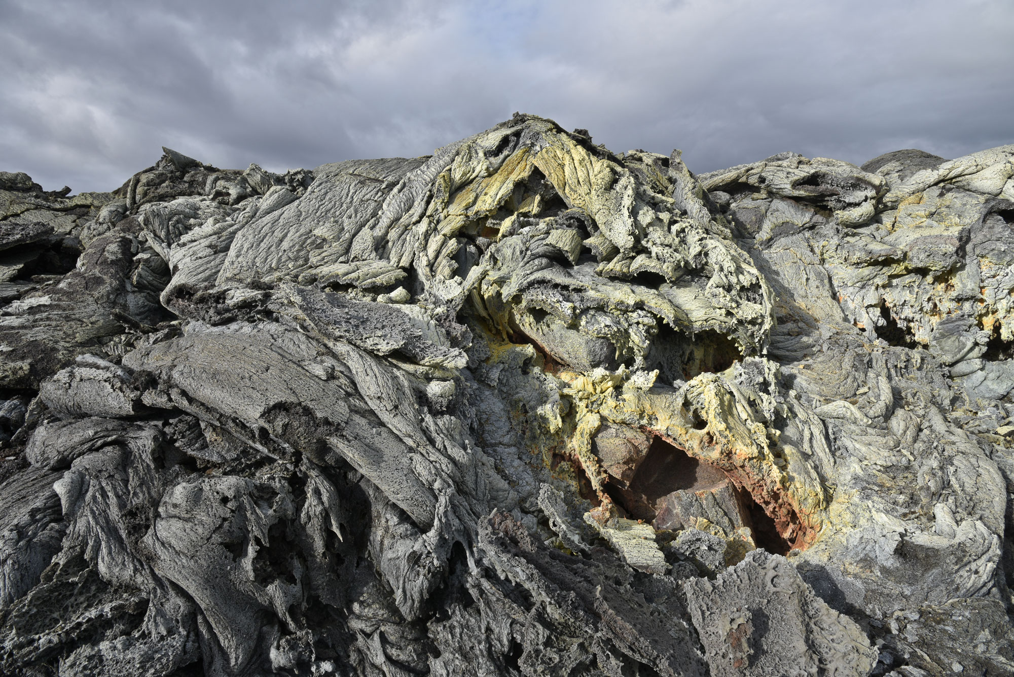
Flow from the recent Geldingadalsgos eruption, with precipitated minerals from cooling pahoehoe lava, Reykjanes, Iceland, June ©2022 hopkins/neoscenes.

field work

The meandering Middle Fork of the South Platte River, from Reinecker Ridge, South Park, Colorado, July ©2020 hopkins/neoscenes.

Reinecker Ridge, east of Fairplay, is a prominent north-south trending ridge rising almost 300 m to 3200 m altitude above relatively flat South Park, Colorado. The bulk of the ridge is comprised of South Park Formation, lower volcaniclastic stratigraphic member (lower Paleocene). It is a poorly sorted and poorly lithified, polymictic, coarse-grained conglomerate yielding isotopic ages ~64-67 Ma. The ridge forms the eastern border of the Buffalo Peaks Ranch, the site of the Rocky Mountain Land Library.

field work

White water-soluble salts precipitating and encrusting sandstone surface at a groundwater seep from the Salt Wash Member of the Morrison Formation in Roubideau Canyon, Montrose County, Colorado, April ©2020 hopkins/neoscenes.

field work

The vast surge of the Uncompaghre Plateau fills the far horizon behind the tan valley of the Gunnison River, and the green sedimentary flanks of Grand Mesa in the foreground, September ©2019 hopkins/neoscenes.
The vast surge of the Uncompaghre Plateau fills the far horizon behind the tan valley of the Gunnison River, and the green Scrub oak (Quercus gamblli) covered sedimentary flanks of Grand Mesa in the foreground, from Lands End, September ©2019 hopkins/neoscenes.

The Gunnison River and its tributaries to the south and west of Grand Mesa along with the Colorado River immediately to the north of the Mesa have eroded more than 5000 ft (1500 m) of the soft sediments underlying the basalt cap of the Mesa in the past nine million years. Those sediments are comprised of the Green River, Wasatch, and Mesaverde Formations of early Tertiary to Late Cretaceous age and are made up of easily eroded (oil) shale, clay and siltstones, along with friable sandstones. The confluence of the Gunnison and Colorado rivers is off to the right of the image about 10 mi (15 km).

field work

The Eocene Green River Formation, forming the slope in the background, contains most oil shale reserves in the state, near Parachute, Colorado, August ©2019 hopkins/neoscenes.

field work

Goemmer Butte, a small intrusive monzonite (volcanic) plug, is considered by the Ute to be a warrior guardian of the Cuchara Valley, Huerfano County, Colorado. June ©2019 hopkins/neoscenes.
Goemmer Butte, a small intrusive monzonite plug (~25 million years old), is considered by the Ute to be a warrior guardian of the Cuchara Valley, Huerfano County, Colorado. June ©2019 hopkins/neoscenes.

field work

The K–Pg (Cretaceous-Paleogene) boundary exposure at Longs Canyon in Trinidad Lake State Park, Colorado, shows an abrupt change from dark- to light-colored rock, October ©2019 hopkins/neoscenes.

field work

Chimney Rock, a resistant column of the Upper Cretaceous Point Lookout Sandstone skirted by Mancos Shale, Towaoc, Colorado, August ©2018 hopkins/neoscenes.

Case Study: Collapsible Soils

[ED: This report was initially sketched out by Jonathan White, Senior Engineering Geologist, (Emeritus) in 2004. Annual damage estimates due to collapsible soils in the US range between $1-$3 billion. Regional hot-spots in the Southwest include parts of Colorado—the Western Slope (Grand Junction), the Eastern Plains, and because of rapid urbanization and development on marginal soils, Douglas and El Paso Counties. Damage to a single residential structure can exceed $100,000 while repair and mitigation of infrastructure (roads and utilities) can run into the millions of dollars for affected regions or projects.]

At the end of the 19th and beginning of the 20th Century, some of the first settlers of the plateau region of western Colorado along the Colorado River, and the Uncompaghre and North Fork of the Gunnison river basins, looked to fruit crops for their livelihood. The semi-arid but moderate climate was well suited for fruit orchards once irrigation canal systems could be constructed.

But serious problems occurred when certain lands were first broken out for agriculture and wetted by irrigation. They sank, so much in places—up to four feet—that irrigation-canal flow directions were reversed, ponding occurred, and whole orchards, newly planted with fruit trees imported by rail and wagon at considerable expense, were lost. While not understood, fruit growers and agriculturists began to recognize the hazards of sinking ground. Horticulturists with the Colorado Agricultural College and Experimental Station (the predecessor of Colorado State University) made one of the first references to collapsible soil in their 1910 publication, Fruit-Growing in Arid Regions: An Account of Approved Fruit-Growing Practices in the Inter-Mountain Country of Western United States. They warned about sinking ground and in their chapter, Preparation of Land for Planting, made one of the first recommendations for mitigation of the hazard. They stated that when breaking out new land for fruit orchards, the fields should be flood irrigated for a suitable time to induce soil collapse, before final grading of the orchard field, irrigation channels excavation, and planting the fruit tree seedlings.


Piping cave/soil arch in Qamf deposit, Loutzenhizer Arroyo, Delta County, Colorado, April 2007. Photo credit: David Noe for the CGS.

more “Case Study: Collapsible Soils”

what’s new under the sun?

Back from a whirlwind trip to Colorado. No personal entries here on the blog for a long time. Sketching an assignment for the Survey job — got until 28 April 2016 to execute the following:

Enclosed is a newsletter [RockTalk Volume 4 #4] created by CGS staff in 2001. The main purpose of the newsletter was educational with a target audience of K-12 teachers, local government planners and elected officials, and the general public. The goal of the newsletter was to educate the public about soil and subsidence hazards and the role of geosciences in their lives.

Your assignment is to take one of the articles in the newsletter: subsidence above inactive coal mines, evaporite karst subsidence, or collapsible soils and develop at least one of the products listed below. You may elect to focus on a subset of the original target audience (if so, please identify the target audience) or target a broad audience. You may use photos or graphics from the original files, modify original files, or create new graphics or photos. If you use graphics or photos created by others, please credit the original source.

— Create a web page about the subject or;

— Create a new newsletter based on the subject, or;

— Create a blog based on the subject [ed: my choice – but the blog since taken down for getting too many hits — I was uncomfortable hosting the site as it had the CGS logo on it and as it proffered critical information].

In addition, to create interest and market your product, please create all of the following:

A social media plan to market your work. You have a budget of $500 to help implement the plan; and an example social media “post” that is primarily text based; and an example social media “post” that is primarily image based.

Deliverables can be links to your work product or pdf documents. The social media marketing plan should be no longer than two pages. The assignment is due by 5 pm MDT, April 28, 2016.

I’ll be fleshing out the blog with media content, so if you have any comments or suggestions, please let me know!

Technical Media Specialist

Enough said:

Colorado School of Mines invites applications for the position of Technical Media Specialist.

The Colorado Geological Survey serves the State of Colorado to ensure that the citizens of Colorado gain most efficient use of and economic benefit from geological resources, while maximizing their protection from geological hazards. Education and research programs affiliated with CGS are enhanced through close collaboration with the strong departments in the College of Earth Resource Sciences and Engineering: Economics & Business, Geology & Geological Engineering, Geophysics, Liberal Arts & International Studies, Mining Engineering, and Petroleum Engineering.

Colorado is well-known for its quality of life and outdoor lifestyles. Mines is located in Golden, Colorado, in a scenic valley at the foothills of the Rocky Mountains. Mines has enrollment of over 5,400 students in undergraduate and graduate degree programs in engineering and applied science. The metropolitan Denver area, with its cultural and sports activities, is located a few miles to the east of Golden. The climate is continental with gentle summers and occasional snow in the winter. There is a major international airport within 35 miles of campus. For more information visit us at: https://www.mines.edu.

Responsibilities: The Technical Media Specialist writes press releases (for what ‘press’?), prepares information for the media (who’s that?) and is responsible for posts/tweets to social media outlets (?), including tracking social media influence measurements. Writes clear and compelling website content (yup), including articles, product descriptions, e-newsletters, blog posts, and podcast scripts. Researches and writes annual reports, newsletters, pamphlets, and other print materials. Works with technical staff to improve document quality, usability and relevance. Other duties include researching material, managing outreach events and agency website, and coordinating content reviews with senior staff. The position assists with general office administration duties and other duties as assigned.

Mines is an Equal Opportunity/Affirmative Action employer and educator that recognizes that diversity is crucial to its pursuit of excellence in learning and research. Mines is committed to developing student, faculty, and staff populations with differing perspectives, backgrounds, talents, and needs and to creating a richer mix of ideas, energizing and enlightening debates, deeper commitments, and a host of educational, research, and service outcomes. As such, Mines values candidates who have experience working in settings with individuals from diverse backgrounds. Minorities, women, veterans, and persons with disabilities are strongly encouraged to apply.

Qualifications: A bachelor’s (MFA) degree in journalism, communications, digital media or a closely related field is required (CHECK). Other requirements include strong writing and editing skills (CHECK); applicants must be able to write clearly, succinctly and in a manner that appeals to a wide audience (CHECK). Must be proficient in the use of Adobe Create Suite, Adobe Creative Cloud or similar print, web content management and digital publication software (CHECK). Applicants must demonstrate, or show evidence of, excellent written, oral communication and interpersonal skills (CHECK). Must be able to take complex, technical information and translate it for colleagues and consumers who have nontechnical backgrounds (CHECK).

Preference will be given to applicants who possess:

• A master’s (PhD) degree in journalism, communications, digital media, or a closely related field (CHECK)

• A bachelor’s degree in geology, geological engineering, engineering, geography, soil science, or a closely related field (CHECK)

• Expert knowledge of social networking channels, web design, HTML and search engine optimization (CHECK)

• Experience working with audio/visual production equipment and other multimedia tools used to distribute podcasts online (CHECK)

• Knowledge of technical subjects such as geology, geological engineering, engineering, geography, soil science, or a closely related field (CHECK)

Posthuman Prospects

The desire to find short cuts and to invent technical solutions is indicative of the impatience of the present age. The utilization of fossil fuels that led to the creation of industrialized societies benefited from the fact that such fuels had accrued their energy potential over millions of years:

All the fossil fuels, in energy terms, are stored sunlight heaped up over geologic time. . . No human being had to put a single day’s work or a single gallon of diesel fuel into growing the tree ferns of the Carboniferous period that turned into Pennsylvanian coal beds, nor did they have to raise the Jurassic sea life that became the oil fields of Texas. The second half of Nature’s energy subsidy took the form of extreme temperatures and pressures deep within the Earth. Over millions of years more, these transformed the remains of prehistoric living things into coal, oil, and natural gas and, in the process, concentrated the energy they originally contained into a tiny fraction of their original size.

These resources, if they had been developed in more sustainable ways, and used to serve more balanced societies, could have benefited us for many years to come, but we have squandered them with our impatience and greed. In an analogous way, we are highly impatient with the technologies that we wish to invent. We are unsatisfied with the intelligence that has been bequeathed to us through millions of years of evolution and we wish to create a copy of it, as soon as possible.

What has been lost is a certain sense of balance, and a knowledge of natural limitations. Ambitious innovation is certainly a virtue but when it relies upon the false premise of unlimited natural resources, or the belief that we can short cut evolution by recreating intelligence at will, it becomes the vice of hubris. Undoubtedly, we will face challenges in the future provoked by advanced technologies. And, equally certain, as we run out of natural resources, governments will increasingly ring fence such resources for themselves to continue with unsustainable military research programs. In this sense, Faye’s two tier system will come to pass although it is unlikely to operate in the interests of European man. Instead, there will be a return to more sustainable, more rural, societies that will have to learn once again what it means to live in accord with natural limitations, and that will be forced to become reacquainted with the slow passing of the seasons.

Pankhurst, C, 2014. Posthuman Prospects: Artificial Intelligence, Fifth Generation Warfare, & Archeofuturism, Counter-Currents Publishing blog, 23 May 23 2014, accessed 29.11.2014.

The Geology of Media

But digital culture is completely dependent on Earth’s long duration. Despite the fallacy that media is increasingly immaterial, wireless, and smoothly clouded by data services, we are more dependent than ever on the geological earth. Geology does not appear in normal conversations about media and culture, but there would be no media without geology. This isn’t a simplistic joke, that without the Earth under our feet there would be no need for universities talking about the Earth or offices of social-media start-ups in Silicon Valley plotting away metaphorical business strategies like the “mining” and “dumping” of data. Rather, the resources and materials gathered from geological depths enable our media technologies to function.

Parikka, J., 2013. The Geology of Media. The Atlantic Online, (October 2013)

Powell’s toil

The relief from danger and the joy of success are great. When he who has been chained by wounds to a hospital cot until his canvas tent seems like a dungeon cell, until the groans of those who lie about tortured with probe and knife are piled up, a weight of horror on his ears that he cannot throw off, cannot forget, and until the stench of festering wounds and anaesthetic drugs has filled the air with its loathsome burden, — when he at last goes out into the open field, what a world he sees! How beautiful the sky, how bright the sunshine, what floods of delirious music pour from the throats of birds, how sweet the fragrance of earth and tree and blossom! The first hour of convalescent freedom seems rich recompense for all pain and gloom and terror.

Something like these are the feelings we experience to-night. Ever before us has been an unknown danger, heavier than immediate peril. Every waking hour passed in the Grand Canyon has been one of toil. We have watched with deep solicitude the steady disappearance of our scant supply of rations, and from time to time have seen the river snatch a portion of the little left, while we were a-hungered. And danger and toil were endured in those gloomy depths, where ofttimes clouds hid the sky by day and but a narrow zone of stars could be seen at night. Only during the few hours of deep sleep, consequent on hard labor, has the roar of the waters been hushed. Now the danger is over, now the toil has ceased, now the gloom has disappeared, now the firmament is bounded only by the horizon, and what a vast expanse of constellations can be seen!

Powell, J.W., 1961. The exploration of the Colorado river and its canyons, New York, NY: Dover Publications.

Bern Porter’s Sciart Manifesto

Finite worlds of infinite reality and beauty revealed by the tools and discoveries of Science are ripe for aesthetic development.

1. Of light, besides the commonly employed natural and artificial, there is the polarized, the radiating chemical, mineral, and radioactive types along with x-ray, cosmic, and nuclear-particle beams with all related electro-optical phenomena.

2. Of other vibrations, there are the natural, the mechanical oscillatory, resonant, and supersonic sound, the entire frequency range of electrical and thermal waves.
more “Bern Porter’s Sciart Manifesto”