
field work

the neoscenes/tech-no-mad (b)log ::
traces pathways and actions encountered and undertaken
On July 31, 1976, a powerful thunderstorm over Colorado’s Big Thompson Canyon unleashed a deluge that became one of the state’s most catastrophic natural disasters. Known as the Big Thompson Flood, this event claimed 144 lives, caused significant damage to infrastructure, and left a lasting impact on both the physical and social landscapes. This flood serves as a case study of the interplay between geologic conditions, meteorology, and human activity in a high-risk environment.

The Big Thompson Flood was caused by an intense, stationary thunderstorm that dropped more than 12 inches of rain in just four hours over the steep canyon. The localized nature of the storm, combined with its high rainfall intensity, overwhelmed the Big Thompson River’s drainage system. This type of weather event is not uncommon in Colorado, where summer thunderstorms can deliver large amounts of precipitation over short periods. The semi-arid climate, combined with the region’s high topographic relief, creates conditions that are particularly conducive to flash flooding.
Thunderstorms of this magnitude occur when warm, moist air is forced upward by the mountainous terrain, cooling and condensing into heavy rainfall. In the case of the Big Thompson Flood, the storm’s stationary position ensured that all the precipitation fell within a confined area, greatly intensifying the flood’s impact.
Big Thompson Canyon, located in the Rocky Mountains of northern Colorado, is a steep and narrow valley carved over millions of years by the Big Thompson River. The canyon’s geology is dominated by granitic bedrock interspersed with loose sediments and colluvium, materials that are easily mobilized during heavy rainfall. The steep canyon walls and limited floodplain amplify the destructive potential of flash floods, as water rapidly accumulates and accelerates downhill.

One of the key factors in the severity of the 1976 flood was the canyon’s geomorphology. The steep gradient of the river increased the velocity of the floodwaters, allowing them to carry massive amounts of sediment, debris, and rock. This debris flow not only caused direct damage but also increased the erosive power of the water, undercutting slopes and triggering landslides that further contributed to the destruction.
Small but significant areas of Colorado are underlain by bedrock that is composed of evaporative minerals. These are salts and sulfates that precipitate out of salt-concentrated surface waters. In the geologic past these minerals were deposited in shallow seas within closed or restricted basins where the seawater evaporation rate exceeded the replenishing supply. Current environments that are similar include the Great Salt Lake in Utah and the Dead Sea in the Middle East. These minerals are predominantly anhydrite (CaSO4) and halite (rock salt – NaCl) at depth, and gypsum (CaSO4*H2O) near the surface. Over geologic time, the evaporative minerals filled the sea basins and were subsequently buried beneath younger sediments. Through burial diagenesis, these deposits become evaporite bedrock. After the Rocky Mountains rose, millions of years of subsequent erosion and downcutting of rivers has now exposed some of these evaporite rocks at the surface.
Two characteristics of evaporite bedrock are important. One is that evaporite minerals can flow, like a hot plastic, under certain pressures and temperatures. The second, and most important to land use and development, is that evaporite minerals dissolve in the presence of fresh water. It is this dissolution of the rock that creates caverns, open fissures, streams outletting from bedrock, breccia pipes, subsidence sags and depressions, and sinkholes. These landforms are described collectively as karst morphology. Karst morphology originally referred to limestone areas known for characteristic closed depressions, sinkholes, caverns, and subterranean drainage. Evaporite karst comprises similar morphology where these features develop as a result of dissolution of the evaporite minerals.
One example of evaporative bedrock in Colorado is the Permo-Triassic Lykins Formation redbeds that contain massive gypsum deposits, up to 50 feet (15 m) thick. Dissolution of those beds and some of the thin algal limestone within the unit is responsible for many sinkholes and ground subsidence features inside the main Dakota Sandstone hogback that marks the boundary of the Eastern Plains and the Front Range.

ED: For new subscribers, selecting the red dot in the middle of the map will start the audio sample which can then be controlled using the play-bar and volume/mute (speaker) icon. Also, a complete library of neoscenes contributions to the aporee::maps project is simultaneously uploaded to https://archive.org.

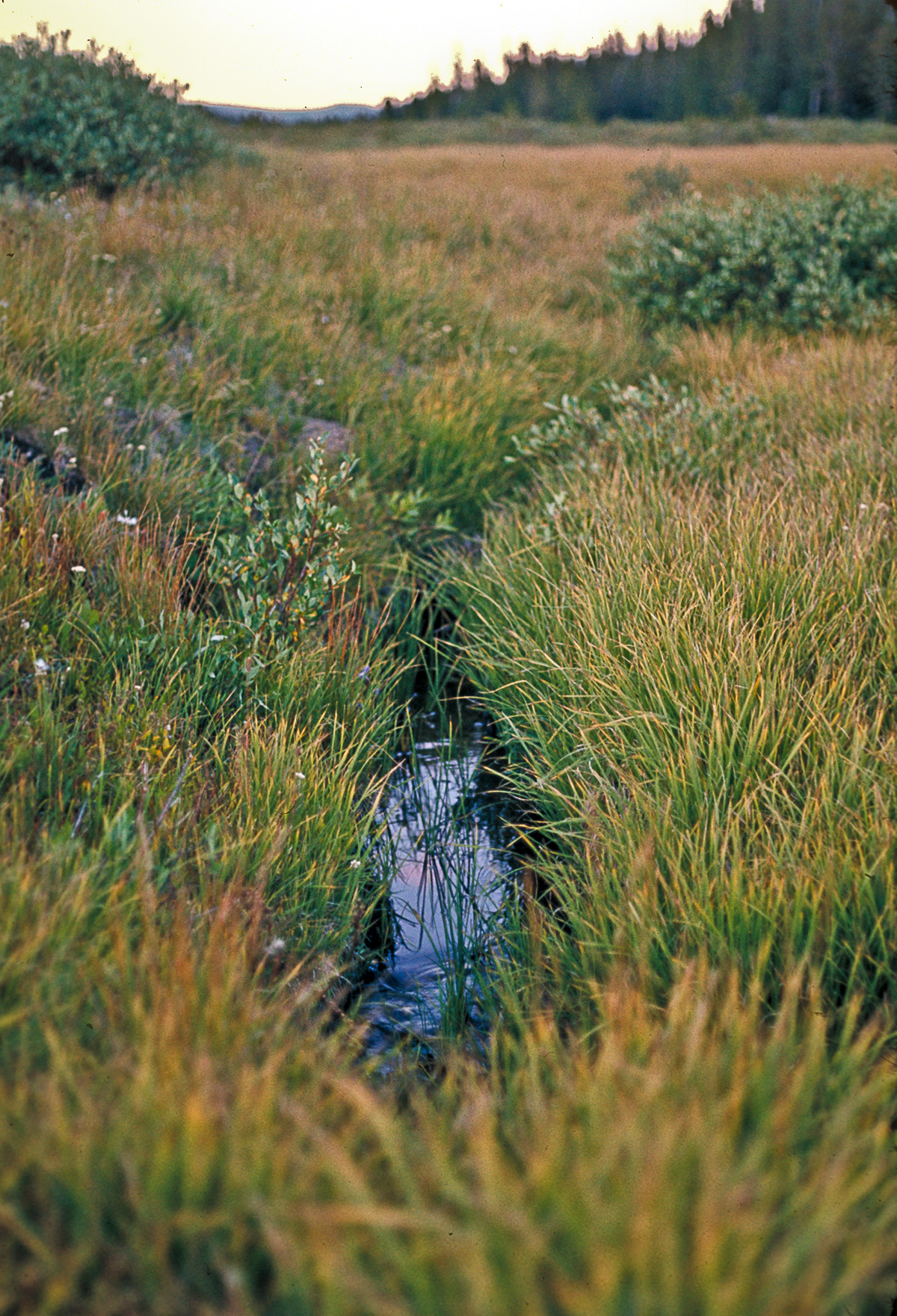
In the process of phonographic listening/recording along Upper Pool Creek west of the Chew Ranch property, I came across this scenario. No clues as to what led up to it. The body seemed to be fresh and whole, life gone that very day perhaps? I didn’t disturb the scene: doubtful that such a nutrient/energy source would remain unconsumed in this wild environment for long.
It did bring back the memory of traveling to Dinosaur back in 1988 with Pablo where we visited his friend Renzo and wife Lisa. Renzo had recently taken the position of wildlife manager for 40,000 sq mi of the Monument and northwest Colorado. One morning, pre-dawn, we set out in his work truck and after a long drive, parked in the low sagebrush steppe and from a distance watched, in the greying Light, a lek where the dramatic mating ritual between dominant male and female Greater sage-grouse unfolded.
ED: For new subscribers, selecting the red dot in the middle of the map will start the audio sample which can then be controlled using the play-bar and volume/mute (speaker) icon. Also, a complete library of neoscenes contributions to the aporee::maps project is simultaneously uploaded to https://archive.org.
On the afternoon of 27 August 2024, the area including Upper Sand Canyon, a relatively small drainage in Dinosaur National Monument, experienced a major precipitation event. The fifteen mile Echo Park access road, in part, runs the full length—about three miles—down that canyon, much of it in the fluvial hazard zone. Long stretches of the road were completely washed out, and it was only the heroic efforts of the guy re-grading it that re-opened access to Echo Park some days later. I recently made it back up to Dinosaur for a short sojourn after an interminable and blurry five-year absence.
Earlier bush-walks along the dry washes in the area, the curious effects of flash-flooding as well as other, slower, changes are noted. I’ve come across dried-mud-caked trees in Upper Pool Creek Canyon more than 20 feet higher than the dry creek bed, yikes! And in some areas of Hells Canyon, boulders the size of small cars are seen piled up and ground together in violent proximity.
With the 27 August incident in mind I did a long bush-walk along the east-west axis of the Ruple Point-Red Rock Anticline that forms the Weber Sandstone hogbacks running perpendicular to Upper Sand Canyon.


ED: For new subscribers, selecting the red dot in the middle of the map will start the audio sample which can then be controlled using the play-bar and volume/mute (speaker) icon.
ED: For new subscribers, selecting the red dot in the middle of the map will start the audio sample which can then be controlled using the play-bar and volume/mute (speaker) icon.
ED: For new subscribers, selecting the red dot in the middle of the map will start the audio sample which can then be controlled using the play-bar and volume/mute (speaker) icon.
ED: For new subscribers, selecting the red dot in the middle of the map will start the audio sample which can then be controlled using the play-bar and volume/mute (speaker) icon.

or …

ED: For new subscribers, selecting the red dot in the middle of the map will start the audio sample which can then be controlled using the play-bar and volume/mute (speaker) icon.
But though Life be so desirous, and Health so great a Blessing, yet how much is both the one and the other undervalued, by the greatest Part of Mankind? Whatever they may think or say of the inestimableness of those precious Jewels, yet ’tis plain, by their Practice, that they put the Slight upon, and despise them both; and the most Man are hardly sensible of the worth of Health, ’till they come in good Earnest to be deprived of it.
How many Men do we daily see, by their Intemperance and Excess, to lay the Seeds of future Distempers, which either carry them off in the flower of their Age, which is the Case of most or else render their Old Age, if they do arrive to it, uneasy and uncomfortable? And though we see others daily drop into the Grave before us, and are very apt with Justice to ascribe the Loss of our Friends, to their living too fast, yet we cannot forbear treading in the same Steps, and following the same Courses, ’till at last, by a violent and unnatural Death, we are hurried off the Stage of Life after them.
What the Noble Cornaro observes of the Italians of his Time, may very well be applied to this Nation at present, viz. “That we are not contented with a plain Bill of Fare; that we ransack the Elements of Earth, Air, and Water, for all sorts of Creatures to gratify our wanton and luxurious Appetites: That as if our Tables were too narrow and short to hold our Provisions, we heap them up upon one another. And lastly, That to create a false Appetite, we rack our Cook’s inventions for new Sauces and Provocations to make the superfluous Morsel go down with the greatest Gust.”
This is not any groundless Observation, but it carries an Experimental Conviction along with it. Look into all our publick Entertainments and Feasts, and see whether Luxury and Intemperance be not too predominant in them. Men, upon such Occasions, think it justifiable to give themselves the Loose, to eat heartily, and to drink deeply; and many think themselves not welcome, or well entertained, if the Master of the Feast be so wise as not to not give them an Occasion of losing the MAN, and assuming the BEAST.

“The Fluvial Hazard Zone (FHZ) is defined as the area a stream has occupied in recent history, may occupy, or may physically influence as it stores and transports water, sediment, and debris.”

Local, state, and federal agencies often collaborate on projects concerning emergency preparedness and community resilience. In this case, the Colorado Geological Survey assisted the Colorado Water Conservation Board (CWCB), the Colorado Department of Local Affairs (DOLA), and local governments by providing technical expertise for the Colorado Hazard Mapping Program (CHAMP). The CHAMP project facilitates effective long-term flood hazard reduction in Colorado. A crucial part of that process is the development of FHZ mapping protocols and debris flow hazard assessments in combination with traditional floodplain mapping. Community engagement and education on the FHZ protocols is ongoing across the state. more “Case study: Fluvial Hazard Zone”
Ed: For new subscribers, selecting the red dot in the middle of the map will start the audio sample which can then be controlled using the play-bar and volume/mute (speaker) icon.

[ED: The far horizon is a portion of Grand Mesa at over 10,000 ft, and the side of the mesa facing the viewer, an area characterized by numerous landslides, is called “Hells Kitchen.” This is the view from my kitchen.]

Ed: For new subscribers, selecting the red dot in the middle of the map will start the audio sample which can then be controlled using the play-bar and volume/mute (speaker) icon.

Ed: For new subscribers, selecting the red dot in the middle of the map will start the audio sample which can then be controlled using the play-bar and volume/mute (speaker) icon.

Ed: For new subscribers, selecting the red dot in the middle of the map will start the audio sample which can then be controlled using the play-bar and volume/mute (speaker) icon.
One of my favorite online feeds is from the NASA Earth Observatory along with their Image of the Day. After catching a recent article on the San Luis Valley, I thought that subscribers might be interested in some of the incredible material that NASA offers on a daily basis. This includes front-line data used in climate research.
“The Earth Observatory’s mission is to share with the public the images, stories, and discoveries about the environment, Earth systems, and climate that emerge from NASA research, including its satellite missions, in-the-field research, and models.”

The Details
Earth Observatory GIS browser – A global map index of thousands of images—one can go direct to Colorado and see more than seventy feature articles covering natural hazards, geology, atmospheric science, and other subjects.
Global Maps – A wide range of maps compiled from satellite data.
Feature Articles – Covering many important topics such as remote sensing, atmosphere, snow & ice, water, and life.
NASA EO blogs – Incredibly informative nuggets of research into the natural world, including several topical blogs:
Earth Matters – Includes in-depth reports on everything from Astronaut Photography to Where on Earth?
Notes From the Field – Stories about how NASA conducts its scientific work and the technologies that make it all possible.
EO Kids – Written for audiences aged 9 to 14, it has many educational features.
Climate Q&A – Includes in-depth answers to common questions about the global climate.
You may also subscribe to different email newsletters and/or RSS feeds
[Ed: As the coauthor who developed the structure and presentation of this first-ever fully online publication at the CGS—the Colorado Groundwater Atlas—I wanted to help draw attention to the issue of groundwater generally. This is an edited version of the initial RockTalk blog post when the Atlas was first published in 2020. Written for both the general public (Sections 1-8 and 13) and a technical audience (Sections 9-12), the Atlas is an excellent primer on this critical and rapidly diminishing resource.]
My neighbor, Christie, directed my attention the The Last Word On Nothing (LWON) blog—she writes for it—and I’ve been reading it regularly over the past couple years. That led to my belated discovery of the work of Colorado-based author Craig Childs who also writes for LWON. He’s “an anecdotal science writer, citizen naturalist, an eye in wild places.” I’m currently absorbing and enjoying his first book of essays, “The Secret Knowledge of Water,” published in 2000, a series of intimate takes on this elemental feature of western landscapes. (Well, technically, “Stone Desert Journal,” published in 1999, and republished in 2022, was his first book.)
Water in the US West is a big deal … I should probably assemble a bibliography of essential readings on the topic! Maybe someday. Meanwhile, I’ve got to go water some of the few native trees on my property with captured rainwater that came last night, it’s been a pretty dry year again, so far.
Everyone knows that water, wherever it might be found—at the surface or underground—is essential for life. However, few people are aware that groundwater is everywhere beneath their feet. It fills the pore spaces between grains of soil, sand, and gravel as well as the fractures and voids in hard bedrock (Figure 02-01 – pdf download). It may be just below the surface—accessible by digging with simple garden tools, or it may be hundreds of feet down in hard rock—requiring expensive drilling with specialized equipment.
more “an aside and the Colorado Groundwater Atlas”I’m no photographer. I take pictures, mostly rather banal pictures: re-creations, re-presentations, documentations of reality. When asked, I tell people that I photograph who I am with, what I am doing, and where I am. Suitably self-centric for the pseudo-artist.
Yes, I show up, with camera. And back when there was a physical craft involved, I excelled in the production of fine archival prints, and I was called a Master Printer. Over the years I taught many courses on the craft: master printing, photographic history, and photography. I have thousands of vintage silver, silver/sepia, and silver/selenium prints that have sat in boxes for the decades since I was last in a wet darkroom, plying that craft.
I still hold onto a selection of superb enlarger lenses, though the last enlarger I had access to—in the darkroom that I built for my father—I gave to the local college back in 2002. Their once-vibrant photography program collapsed a few years later. So much for craft, gotta sell those lenses.

Not only that, I still can’t get a true horizontal horizon line! Dammit! Simple composition, strictures I never liked, were not transcended to a level where they could intentionally be disposed of entirely.
After five years of not carrying an analog 35mm camera, shooting only miniDV video from 2000 through 2006, I picked up a DSLR with a lens that gradually reduced itself over more than a decade’s use to a piece of garbage. And forget a clean CCD sensor. It’s worse than in the ‘old times’ with spurts of Dust-Off and manually spotting (or ‘re-touching’) negatives and prints with Spotone and tiny paint brushes. CCDs manifest every dust speck as large dark circles on the screen (and in print). Got a clear sky? Guaranteed to be covered in more-or-less distinct circular blobs. I finally upgraded to a true professional-grade DSLR a few years back—as usual, behind the current mirror-less technology—always several steps behind any state-of-the-art. The only time I was near that was when I was shooting with the two Nikon F2a bodies and a selection of decent lenses that my father generously handed down to me back in the late 1970s.
The successful Kickstarter campaign in 2013 to acquire a high-end large-format printer ended during Covid when—after seven years of pointless printing—one nozzle got clogged and I didn’t immediately address the issue to fix it. The printer is now a 250-pound paperweight. I could perhaps revive it, but that would require buying a full set of inks, a $2500 investment that might not pay off in the end. I only sold a handful of prints total, and gave away many more than that, by far.
At this point, my images are hardly ‘collectible’ and so the only photographic medium I am using currently is this travelog. That will not change for the duration—despite this virtual world already jam-packed with trillions of images—until the energy winds down, and all archives become cold stardust fodder.
Ed: For new subscribers, selecting the red dot in the middle of the map will start the audio sample which can then be controlled using the play-bar and volume/mute (speaker) icon.

[ED: I decided to re-work and re-publish some of the public-domain articles that I compiled and wrote for the CGS as they are no longer updating the widely-read >RockTalk< blog that I established for them back in 2016.
Public interest regarding human-caused water pollution from abandoned mines remains high following the Gold King Mine event in 2015. Complicating the overall water-quality issue is the presence of natural pollution sources that affect the baseline condition of many watersheds across the state. These areas are often accompanied by obvious surface indicators as depicted in the photos.]
Are so-called pristine mountain waters always clean and pure? Can streams unaffected by human activities and livestock influences be unfit for human consumption, or for aquatic life? The existence of natural acid rock drainage (NARD) suggests a “no” to the former, and a “yes” to the latter question.
But what exactly is NARD?

2024.05.05 framework radio :: program details
06:30 – 16:50 / john hopkins / neoscenes: BNA gate T1 bathroom / nashville, us / aporee soundmaps https://aporee.org/maps/?loc=63914
Ed: For new subscribers, selecting the red dot in the middle of the map will start the audio sample which can then be controlled using the play-bar and volume/mute (speaker) icon.
Ed: For new subscribers, selecting the red dot in the middle of the map will start the audio sample which can then be controlled using the play-bar and volume/mute (speaker) icon.

