
glitchworks
the neoscenes/tech-no-mad (b)log ::
traces pathways and actions encountered and undertaken
A subset of creative projects initiated under or participated in by the hopkins/neoscenes umbrella
On 9 August 1967, Denver experienced an earthquake that caught the city’s residents by surprise. The tremor, which registered 5.3 on the Richter scale, was particularly notable as it occurred in a region not typically associated with significant seismic activity. What made this earthquake even more remarkable was its eventual connection to human activity—specifically, the disposal of wastewater at the Rocky Mountain Arsenal, a chemical weapons manufacturing facility northeast of the city. This event would later become a classic case study in induced seismicity, where human actions trigger earthquakes, and it helped establish important precedents for understanding the relationship between fluid injection into the ground and subsequent seismic events.
One of the strongest and most economically damaging earthquakes to affect the Denver area in the 1960s occurred on August 9, 1967 around 6:30 AM, awakening and frightening thousands of people. This magnitude 5.3 earthquake, centered near Commerce City, caused more than eight million dollars (2022 dollars) in damage in Denver and the northern suburbs.
Felt reports and intensity ratings were described by von Hake and Cloud (1984). Intensity VII damage was reported in Northglenn, where plate glass windows broke, many walls, ceilings, foundations, and concrete floors cracked, and several businesses sustained damage due to fallen merchandise. One liquor store had estimated damage at USD $90,000 to $175,000 (2022 dollars).
Intensity VI damage was reported in 28 locations, many of which suffered considerable cracked plaster and mortar, broken windows, damaged foundations and chimneys, and damage to household goods. The earthquake was felt as far as Sterling to the northeast and Pueblo, Colorado to the south, as well as north to Laramie, Wyoming.
Based on the isoseismal map, the estimated felt area was about 20,000 mi2 (50,000 km2). Von Hake and Cloud (1984) proposed a size of 15,000 mi2 (39,000 km2), while Hadsell (1968) indicated it was felt over 45,000 mi2 (117,000 km2). Docekal (1970) reported a felt area of 20,000 mi2 (52,000 km2). A magnitude of Mb 5.3 was reported for this earthquake by von Hake and Cloud (1969). Nuttli and others (1979) calculated an Mb of 4.9 and ms of 4.4. Herrmann and others (1981) suggested a focal depth of 1.9 mi (3 km) for this event. The overall felt area is prominently elongated in directions parallel and perpendicular to the (north-south oriented Front Range) mountain front. The intensity V and VI contours are also oriented in an elongate pattern perpendicular to the mountain front.

This substantial earthquake, the largest of a long series, is believed to have been triggered by the deep injection of chemically-charged wastewater into a borehole drilled to a depth of 12,045 ft (3671 m) at the Rocky Mountain Arsenal in 1961. It was followed by an earthquake of magnitude 5.2 on November 27, 1967. In total, between 1962 and 1967 the U.S. Geological Survey (USGS) recorded over 1,500 earthquakes in the area. The Arsenal was a large chemical weapons-manufacturing facility run by the U.S. Army in Commerce City. Wastewater injection at the site stopped in 1966 and the entire facility closed in 1992. Much of the area is now a national wildlife refuge.
Citations NOTE: The ON-002 Earthquake Reference Collection which includes most of the following references, and 700 more—is available to researchers—see instructions on that page to access the collection.


However, a few glances at most were cast upward, perhaps followed by isolated comments about how beautiful the evening was, for sights like this were not exceptional, on the contrary, hardly a day passed without the sky being filled with fantastic cloud formations, each and every one illuminated in unique, never-to-be-repeated ways, and since what you see every day is what you never see, we lived our lives under the constantly changing sky without sparing it a glance or a thought. And why should we? If the various formations had had some meaning, if, for example, there had been concealed signs and messages for us which it was important we decode correctly, unceasing attention to what was happening would have been inescapable and understandable. But this was not the case of course, the various cloud shapes and hues meant nothing, what they looked like at any given juncture was based on chance, so if there was anything the clouds suggested it was meaninglessness in its purest form.

The photos were made around the same time Karl Ove was living in Bergen: I was teaching at KHiB (now the Faculty of Fine Art, Music and Design, University of Bergen). Probably no need to explain the resonance of this particular passage to other entries on this blog.


My favorite aunt, Mary MacKenzie, was Dr. Toms’ secretary for many years. She is in both photos, with dark hair, at the top of the stairs in the middle, holding her sunglasses and camera, and on the second photo, fourth from the far left, again holding her sunglasses, up in the air. Dr. Toms, aka “Kahu,” is the somewhat impassive fellow in the dark suit and sunglasses looking more like a Secret Service agent … Hawaii-Five-O, here we come!

At the vilma offices thanks to Gediminas and Nomeda — for hosting the stream I’m sending to Steve of art@radio in Baltimore who has an elaborate studio set-up for the live streaming he’ll be doing from there to The Long Night of Radio Art that is part of the Reinventing Radio project of KunstRadio. the whole project will be broadcast on FM, shortwave, a special 5.1 digital satellite transmission, and online. (Taking a breath). Yeah, live online. Meet August on the IRC channel broadcasting from Santa Barbara.


“jamming radiophonic space,” modulates the interplay of radio, Internet, wireless transmission, an private space.
This experientially diverse and geographically scattered group will contribute to “jamming radiophonic space” through decentralized, networked, and collaborative strategies of production and distribution. Streaming feeds from microphones places in and around artists’ workspaces will be gathered along with ambient sound called in via wireless and landline phones; requests have already gone out over electronic list-serves for individuals to call in and point their live phones for 10 or 15 minutes towards sounds emblematic of their time and place.
These sonic interruptions will then be mixed and processed into a stream of “hot media” by artists present in the Baltimore studio space using baby monitors, short-wave radios, software, and other improvised sound tools. The stream will then be made available world-wide to streaming clients via wired and wireless data connections.
Artists:
Chris Basile, Goeff Bell, Steve Bradley, Phaye Poliakoff-Chen, Chad Eby, John Hopkins (Vilnius, LT), Brendan Howell, John Hudak, Jacob Kirkegaard, Tim Nohe, Joe Reinsel, Jodi Rose, Bill Shewbridge, Nicole Shiflet, John Sturgeon, and others …


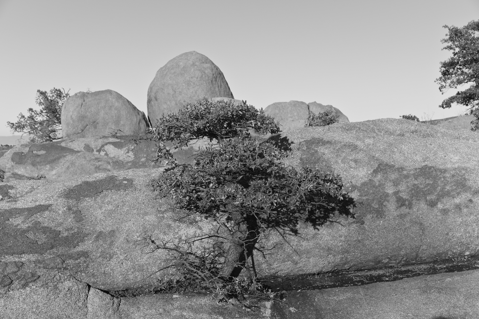
[ED: Documentation, yes. That’s all I do with the photography, all I ever did. Documenting immediate life scrolling by. And let that accumulate into a modest mass of imagery. Extracted from the mass, they appear fragmentary, and not so replete with ‘meaning.’ Here’s a handful from a warm 1988 summer’s end.]
Upon my re-patriation after three months in Iceland, Germany, Italy, France, Luxembourg, Denmark, Norway, and Sweden, following is a sample of what happened hanging with Willy & Andy in Hoboken:


These are the overarching geoscience categories that drove the generation of the full keyword cloud:
Geologic Units; Geologic Temporal; Geologic Terms; Geohazard Terms; CGS Research/Expertise Areas; GIS/map-related; Publication Type Codes; Medium/format; Locations: Geologic Regional, Mtns/Range, Rivers, Towns, Counties; Decades
This is the final specific keyword cloud for the Colorado Geological Survey that was applied across the entire (meta)/data/information space when/wherever possible:
* denotes keywords that refer to multiple items with the same name (cities, counties, etc.); and the bolded terms are the five overarching categories of expertise for the organization. These five were used as an ‘upper-level’ basis for organizing the web presence/navigation system.
I received no consequent support from CGS management for the process I undertook implementing a keywording system. Their info/dataspace was in disarray and between the public-facing and internal spaces there was no consistency in even the most basic of data organizational principles (like file naming). Given that the organization was, ostensibly, about science, this seemed to be a major lapse if only from the standpoint of consistency and repeatability. And, given my own responsibilities—publications, editing, social media and web work—directly related to the space, it was essential to do something!
Generating an effective keyword system requires careful balance and deliberate constraints to remain useful. While it’s tempting to create extensive tag clouds, an over-saturated system quickly becomes unwieldy and defeats its purpose of improving information findability. For most systems, an upward limit of ~500 keywords is optimal.
A strong keyword strategy needs to reflect both organizational needs and user behavior patterns, incorporating essential discipline-specific terminology and terms that apply to dispersed-but-related information. However, the keyword universe must be intentionally limited—being selective and strategic about which terms make the cut rather than allowing unlimited growth.
User perspectives are crucial in determining these constraints. I did spend time observing my colleagues, asking them about their search methodologies, and how they managed their own data. The forthcoming information generally illustrated what I observed among my media students: a lack of understanding of what “search” meant in a digital environment. Keywords should reflect how people actually search for content, although most people have rather idiosyncratic ways of dealing with information, often based on their first encounters with the digital tools involved. Generational differences in this regard are substantial, and do change all the time. The implementation of AI into the process are radically changing search processes along with the fundamentals surrounding the very presentation of information on the Internet itself.
A focus on standardizing is crucial, but this restriction will run up against that idiosyncrasy instantly, often with problematic results. Recognized and respected processes for responsible governance of a keyword system are necessary. That said, because of the resources needed to do the actual content tagging, a more-or-less static set of agreed-upon terms is best. If, for example, a new term is added, the entire dataspace should be reviewed for relevant placement of that new term. Otherwise there will be datasets that will not show up in search returns, rendering them redundant and reducing the overall value of data assets, and, negating the entire concept of standards.
According to sources, the CGS has apparently abandoned the keyword application process and even basic file-naming and filing conventions. So counterproductive! Good luck finding stuff!
My god, finally ran through the entire video production sequence in FinalCut Pro / QuickTime, etc., to get a simple sketch piece to the blog. It’s not optimal as the original footage is from an old iPhone versus a newer iPad Pro and such, but … First time in a couple years, it’s always such a hassle to start with raw video, an idea, and squeeze that through an endless series of constant externally-imposed permutations on editing platforms and exporting formats/codecs/resolutions that are currently acceptable to most browsers and servers. Especially when memory is compromised! gah!
This, a circuit (aka, cycle) around the center of the universe, something I ritually perform on each visit. I have used the circuit/cycle concept to ascribe the presence of place and presence within that place. It dates back to the very early piece “memories of three infinite half-spaces” filmed at the site of a huge jökulhlaup in Iceland in 1997.
The audio is a simple ambient track recorded from the base of a telephone pole near the center, droning on in the -20F winter night chill of the Valley.


For decades, the west side of the Colorado School of Mines (CSM) main campus had subsidence issues related to historical mining activities. At one point, in the 1990s, one of the married student housing units in that area was so badly damaged that it was condemned. In the early 2000s, after the school converted the subsidence-prone area into intramural-athletic (IM) fields, ongoing subsidence-related issues were still being reported.
Clay mining in Colorado dates back to the mid-1800s and Golden was a particularly good location for clay found in the Laramie Formation. This clay has been used for a variety of industrial purposes over the years including construction (bricks, structural tiles, sewer pipes), terracotta, refractory clays, and earthenware. The mining of kaolinitic claystones in what was later to become the western area of the Mines campus left backfilled/collapsed mine workings and the possible presence of underground void spaces. To complicate matters, that same area was also the site of coal mining in the 1880s and 1890s. In particular, the Pittsburg Coal Mine entry shaft may have been located in the vicinity of one of the observed subsidence features. This mine reportedly operated between 1876 and 1880, but is un-recorded by the State. The mining operations were thought to be on three levels at depths of 100, 150, and 225 feet running parallel to the mountains.


[ED: This brief report from 1995 was written by Jon White, (Senior Engineering Geologist, emeritus). It looks at a specific rockfall situation in the central Front Range town of Manitou Springs. There are hundreds of similar instances like this where gravity rules in mountainous terrain. Geotechnical solutions are of some help in the long-term scale of the hazards, but are extremely expensive to implement. Development pressures that are affecting building in areas threatened by natural disasters—of small and large scale—continue apace in the US West.]
Manitou Springs occupies a narrow valley where Fountain Creek emerges from the foothills northeast of Pikes Peak and west of Colorado Springs. The valley slopes are composed of interbedded resistant sandstone and conglomerates (i.e., gravelly sandstone), and weaker mudstones and shale. The outcropping sandstone is most prevalent on the steeper slopes on the north side of the valley.
During the wet spring of 1995, rockfall and landslide incidents increased throughout Colorado, some resulting in fatalities. In Manitou Springs, a fortunate set of circumstances occurred before the Memorial Day holiday weekend when local residents observed the movements of a large, dangerous block of rock before it actually could fall. The observation set into motion an emergency declaration by the town, resulting in a compulsory evacuation of homes located below the rocky slope, the closing of the road in the area, and an immediate rock stabilization project. During this emergency situation, the Colorado Geological Survey was asked to provide expert assistance to help stabilize the rock. The emergency evacuation decree remained in effect until the rock was stabilized and the area subsequently declared safe.


ED: For new subscribers, selecting the red dot in the middle of the map will start the audio sample which can then be controlled using the play-bar and volume/mute (speaker) icon. Also, a complete library of neoscenes contributions to the aporee::maps project is simultaneously uploaded to https://archive.org.
ED: For new subscribers, selecting the red dot in the middle of the map will start the audio sample which can then be controlled using the play-bar and volume/mute (speaker) icon. Also, a complete library of neoscenes contributions to the aporee::maps project is simultaneously uploaded to https://archive.org.
ED: For new subscribers, selecting the red dot in the middle of the map will start the audio sample which can then be controlled using the play-bar and volume/mute (speaker) icon.
ED: For new subscribers, selecting the red dot in the middle of the map will start the audio sample which can then be controlled using the play-bar and volume/mute (speaker) icon.

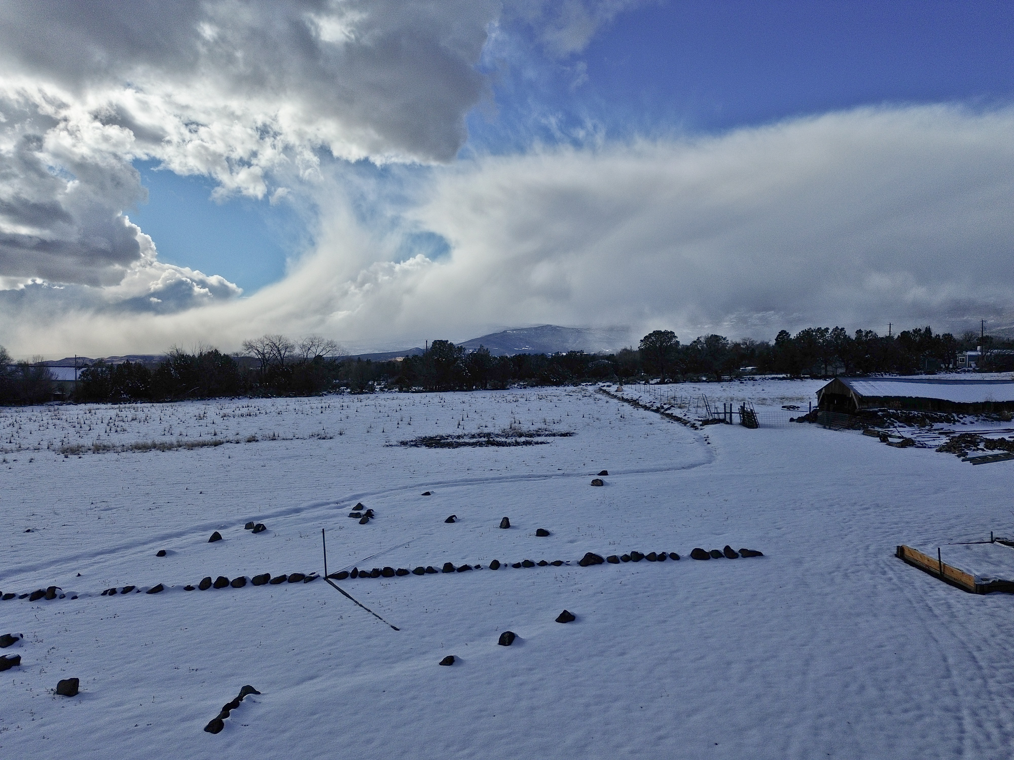
[ED: The far horizon is a portion of Grand Mesa at over 10,000 ft, and the side of the mesa facing the viewer, an area characterized by numerous landslides, is called “Hells Kitchen.” This is the view from my kitchen.]
ED: For new subscribers, selecting the red dot in the middle of the map will start the audio sample which can then be controlled using the play-bar and volume/mute (speaker) icon.
ED: For new subscribers, selecting the red dot in the middle of the map will start the audio sample which can then be controlled using the play-bar and volume/mute (speaker) icon.
ED: For new subscribers, selecting the red dot in the middle of the map will start the audio sample which can then be controlled using the play-bar and volume/mute (speaker) icon.
Ed: For new subscribers, selecting the red dot in the middle of the map will start the audio sample which can then be controlled using the play-bar and volume/mute (speaker) icon.

[ED: If you could see the far horizon, it is comprised of a portion of Grand Mesa at over 10,000 ft, and the side of the mesa facing the viewer, an area characterized by numerous landslides, is called “Hells Kitchen.” This is the view from my kitchen. Another note, my property sits on a large alluvial fan (many tens of sq mi) descending from the Mesa and fueled by Surface Creek. The slope of the fan is minus 10-12 degrees from horizontal, as demonstrated from right to left in the photo.]

[ED: The far horizon is a portion of Grand Mesa at over 10,000 ft, and the side of the mesa facing the viewer, an area characterized by numerous landslides, is called “Hells Kitchen.” This is the view from my kitchen.]
Ed: For new subscribers, selecting the red dot in the middle of the map will start the audio sample which can then be controlled using the play-bar and volume/mute (speaker) icon.
Ed: For new subscribers, selecting the red dot in the middle of the map will start the audio sample which can then be controlled using the play-bar and volume/mute (speaker) icon.
Ed: For new subscribers, selecting the red dot in the middle of the map will start the audio sample which can then be controlled using the play-bar and volume/mute (speaker) icon.
Ed: For new subscribers, selecting the red dot in the middle of the map will start the audio sample which can then be controlled using the play-bar and volume/mute (speaker) icon.
Ed: For new subscribers, selecting the red dot in the middle of the map will start the audio sample which can then be controlled using the play-bar and volume/mute (speaker) icon.
[Ed: As the coauthor who developed the structure and presentation of this first-ever fully online publication at the CGS—the Colorado Groundwater Atlas—I wanted to help draw attention to the issue of groundwater generally. This is an edited version of the initial RockTalk blog post when the Atlas was first published in 2020. Written for both the general public (Sections 1-8 and 13) and a technical audience (Sections 9-12), the Atlas is an excellent primer on this critical and rapidly diminishing resource.]
My neighbor, Christie, directed my attention the The Last Word On Nothing (LWON) blog—she writes for it—and I’ve been reading it regularly over the past couple years. That led to my belated discovery of the work of Colorado-based author Craig Childs who also writes for LWON. He’s “an anecdotal science writer, citizen naturalist, an eye in wild places.” I’m currently absorbing and enjoying his first book of essays, “The Secret Knowledge of Water,” published in 2000, a series of intimate takes on this elemental feature of western landscapes. (Well, technically, “Stone Desert Journal,” published in 1999, and republished in 2022, was his first book.)
Water in the US West is a big deal … I should probably assemble a bibliography of essential readings on the topic! Maybe someday. Meanwhile, I’ve got to go water some of the few native trees on my property with captured rainwater that came last night, it’s been a pretty dry year again, so far.
Everyone knows that water, wherever it might be found—at the surface or underground—is essential for life. However, few people are aware that groundwater is everywhere beneath their feet. It fills the pore spaces between grains of soil, sand, and gravel as well as the fractures and voids in hard bedrock (Figure 02-01 – pdf download). It may be just below the surface—accessible by digging with simple garden tools, or it may be hundreds of feet down in hard rock—requiring expensive drilling with specialized equipment.
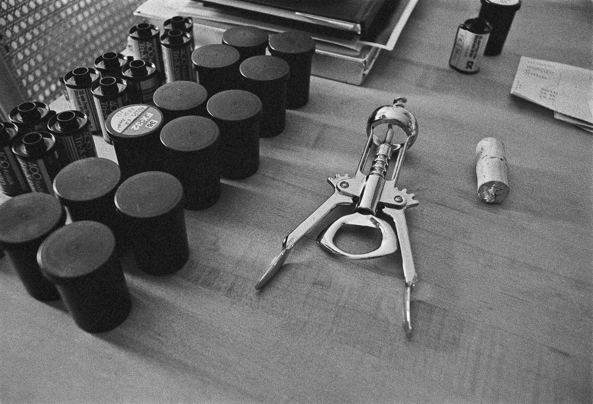
more “an aside and the Colorado Groundwater Atlas”I’m no photographer. I take pictures, mostly rather banal pictures: re-creations, re-presentations, documentations of reality. When asked, I tell people that I photograph who I am with, what I am doing, and where I am. Suitably self-centric for the pseudo-artist.
Yes, I show up, with camera. And back when there was a physical craft involved, I excelled in the production of fine archival prints, and I was called a Master Printer. Over the years I taught many courses on the craft: master printing, photographic history, and photography. I have thousands of vintage silver, silver/sepia, and silver/selenium prints that have sat in boxes for the decades since I was last in a wet darkroom, plying that craft.
I still hold onto a selection of superb enlarger lenses, though the last enlarger I had access to—in the darkroom that I built for my father—I gave to the local college back in 2002. Their once-vibrant photography program collapsed a few years later. So much for craft, gotta sell those lenses.

Not only that, I still can’t get a true horizontal horizon line! Dammit! Simple composition, strictures I never liked, were not transcended to a level where they could intentionally be disposed of entirely.
After five years of not carrying an analog 35mm camera, shooting only miniDV video from 2000 through 2006, I picked up a DSLR with a lens that gradually reduced itself over more than a decade’s use to a piece of garbage. And forget a clean CCD sensor. It’s worse than in the ‘old times’ with spurts of Dust-Off and manually spotting (or ‘re-touching’) negatives and prints with Spotone and tiny paint brushes. CCDs manifest every dust speck as large dark circles on the screen (and in print). Got a clear sky? Guaranteed to be covered in more-or-less distinct circular blobs. I finally upgraded to a true professional-grade DSLR a few years back—as usual, behind the current mirror-less technology—always several steps behind any state-of-the-art. The only time I was near that was when I was shooting with the two Nikon F2a bodies and a selection of decent lenses that my father generously handed down to me back in the late 1970s.
The successful Kickstarter campaign in 2013 to acquire a high-end large-format printer ended during Covid when—after seven years of pointless printing—one nozzle got clogged and I didn’t immediately address the issue to fix it. The printer is now a 250-pound paperweight. I could perhaps revive it, but that would require buying a full set of inks, a $2500 investment that might not pay off in the end. I only sold a handful of prints total, and gave away many more than that, by far.
At this point, my images are hardly ‘collectible’ and so the only photographic medium I am using currently is this travelog. That will not change for the duration—despite this virtual world already jam-packed with trillions of images—until the energy winds down, and all archives become cold stardust fodder.

[ED: The far horizon is a portion of Grand Mesa at over 10,000 ft, and the side of the mesa facing the viewer, an area characterized by numerous landslides, is called “Hells Kitchen.” This is the view from my kitchen. Another note, my property sits on a large alluvial fan (many tens of sq mi) descending from the Mesa and fueled by Surface Creek. The slope of the fan is minus 10-12 degrees from horizontal, as demonstrated from right to left in the photo.]
Ed: For new subscribers, selecting the red dot in the middle of the map will start the audio sample which can then be controlled using the play-bar and volume/mute (speaker) icon.

2024.05.05 framework radio :: program details
06:30 – 16:50 / john hopkins / neoscenes: BNA gate T1 bathroom / nashville, us / aporee soundmaps https://aporee.org/maps/?loc=63914

neoscenes is again participating in the Reveil global audio streaming project for the tenth year, adding a small sonic expression to this ongoing collaborative broadcast: Reveil 24-hour live broadcast 2024 (one dimension of Soundcamp) 03-05 May (depending on your time zone — see below for exact local times).
Streams come from a variety of locations and situations, at a time of day when many people are unaccustomed to be up and out, but sounds are vivid, especially in Spring. The Reveil broadcast makes room by largely avoiding speech and music, gravitating to places where human and non human communities meet and soundworlds overlap.
Sounds produced by birds, amphibians, weather, fish, electromagnetic fluctuations, people, machines, vegetation, transmission artifacts, convey the variety of planetary soundscapes, captured from many specific places and projects. In the process, Reveil brings together dispersed and lesser known ecological projects and practices across disciplines and time zones, in a sketch of an acoustic commons in the making.
Streams range from temporary projects in people’s homes to large research networks. Each open microphone adds to the diversity of the mix.
You can tune in to the overall 25-hour Reveil stream at the Reveil platform or on Wave Farm Radio or at Resonance Extra.
neoscenes/Reveil 2024 landing page: https://streams.soundtent.org/2024/streams/utc-6_-9b9ee361-46a4-4315-be94-985377df3a5f [active during event only]
The neoscenes stream, hosted on the locusonus soundmap will be live for the entire weekend; it will be selectively broadcast in the Reveil stream as follows:
Date: 06 May 05:50-06:20 AM MDT UTC-6 (this is the approximate time that the neoscenes stream will be mixed into the whole 25-hour stream)
Civil twilight (local time): 5:40 AM / 0538 (UTC-6) Local time in Cedaredge
Sunrise (local time): 6:07 AM / 0606 (UTC-6) Local time in Cedaredge
Location: online and Cedaredge, Colorado, USA
Streamer: John Hopkins / neoscenes
Coordinates: N +38.92349163182399° / W107.91730709264802°
Timezone: MDT UTC-6 — 7 hours behind London
Ed: For new subscribers, selecting the red dot in the middle of the map will start the audio sample which can then be controlled using the play-bar and volume/mute (speaker) icon.