
field work

the neoscenes/tech-no-mad (b)log ::
traces pathways and actions encountered and undertaken

One of my favorite online feeds is from the NASA Earth Observatory along with their Image of the Day. After catching a recent article on the San Luis Valley, I thought that subscribers might be interested in some of the incredible material that NASA offers on a daily basis. This includes front-line data used in climate research.
“The Earth Observatory’s mission is to share with the public the images, stories, and discoveries about the environment, Earth systems, and climate that emerge from NASA research, including its satellite missions, in-the-field research, and models.”

The Details
Earth Observatory GIS browser – A global map index of thousands of images—one can go direct to Colorado and see more than seventy feature articles covering natural hazards, geology, atmospheric science, and other subjects.
Global Maps – A wide range of maps compiled from satellite data.
Feature Articles – Covering many important topics such as remote sensing, atmosphere, snow & ice, water, and life.
NASA EO blogs – Incredibly informative nuggets of research into the natural world, including several topical blogs:
Earth Matters – Includes in-depth reports on everything from Astronaut Photography to Where on Earth?
Notes From the Field – Stories about how NASA conducts its scientific work and the technologies that make it all possible.
EO Kids – Written for audiences aged 9 to 14, it has many educational features.
Climate Q&A – Includes in-depth answers to common questions about the global climate.
You may also subscribe to different email newsletters and/or RSS feeds


neoscenes joins the 2016 live broadcast of the Reveil 24-hour stream 2016 that is part of Soundcamp:
REVEIL relays the sounds of live open microphones provided by streamers around the world.
Starting on the morning of Saturday 30 April just before daybreak in Rotherhithe near the Greenwich Meridian, the Reveil broadcast tracks the sunrise west from microphone to microphone, following the wave of sound that loops the earth every 24 hours.
Sounds are provided by the LocusSonus network and other streamers, together with a collection of live audio sources assembled for this broadcast.
REVEIL is different from the vast majority of radio available online: it is not dedicated mainly to music or talk, and none of it is pre-recorded. Each sound is propagating live somewhere in real time.
Our aim is to open a space for listening to something else – especially, but not exclusively to non humans and from wild places – and in the course of one earth day to provide a sketch of this emerging field.
The Live Audio Archive is both paradoxical and fluid: streams come and go in response to technical issues, seasonal changes, and the movement of people and other creatures on different projects or migrations.
This feed is sent from the small under-reconstruction cabin studio of Dr. John Hopkins (aka neoscenes), a visual/sonic media artist and learning facilitator. He holds a creative practices PhD from La Trobe University/University of Technology Sydney, an MFA from the University of Colorado Boulder (where he studied film under renown experimental film-maker, Stan Brakhage), and a BSc in Geophysical Engineering from the Colorado School of Mines. His transdisciplinary research and workshops explore issues surrounding sustainable creative practices, ‘big-picture’ system views, networked & tactical media, distributed and community-based DIY & DIWO processes, networked creativity, and Temporary Autonomous Zones. His international media arts practice explores the role of energy in techno-social systems and the effects of technology on energized human encounter. He has taught across more than 20 countries and 60 higher education situations. He is currently hunting for meaningful work in a social system that is itself under severe psycho-spiritual duress. Is this the beginning of collapse?
Here’s a recording of the stream as it happened:
(01:25:21, stereo audio, 207.2 mb)
The neoscenes stream parameters:
Date: 30 April 0445-0600 MST UTC-7
Location: Prescott, Arizona, USA
Streamer: John Hopkins
Link(s): https://streams.soundtent.org/2016/streams/utc-7_prescott-arizona
Coordinates: N 34 31′ 48.763″ / W 112 28’56.712″
Timezone: MST UTC-7 [no DST] 8 hours behind London
Civil twilight (local time): 5.12 AM / 0512
Sunrise (local time): 5.39 AM / 0539
Broadcast window (London time): 13.12 – 13.39
Start time (approximate – London time): 13.25
TUNE IN HERE: My continuous stream is live between 29 April – 01 May [and of course, during the broadcast window listed above]: https://streams.soundtent.org/2016/streams/utc-7_prescott-arizona
OR AT my direct locus-sonus stream: https://locus.creacast.com:9001/neoscenes.m3u (this URL is live sporadically before and after the actual dawn stream time period). You can copy/paste the address into iTunes (use ‘File’ menu — ‘Open Stream’ option), or other mp3 players once it’s live. Headphones recommended to capture the ethereal density of the stream!
Reveil is in collaboration with the International Dawn Chorus Day.


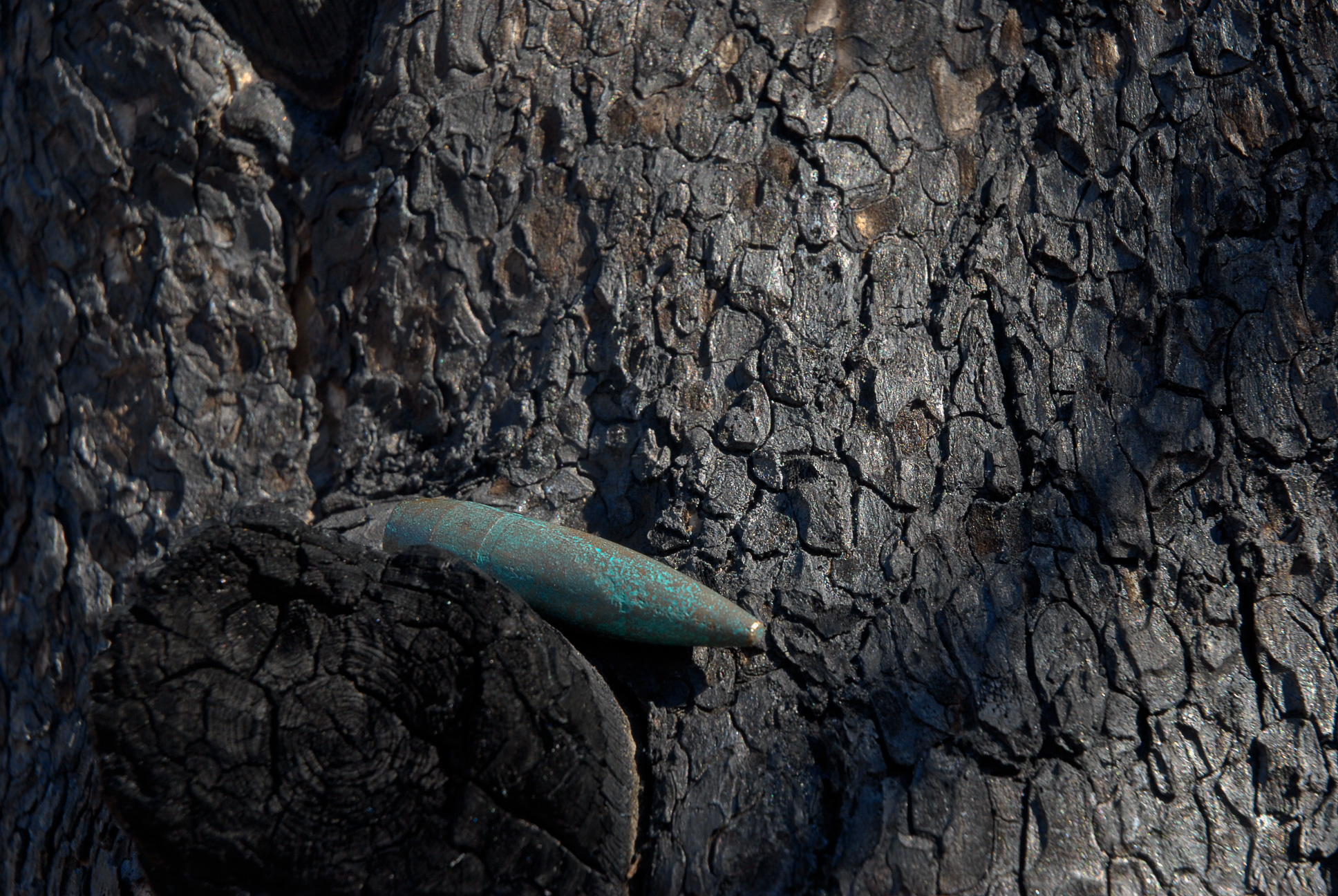
Entering the zone on the north side of Granite Mountain Wilderness area on a long and mesmerizing transit. It’s the site of a massive wildfire burn from last June: I feel a bit like I’m in Tarkovsky’s Stalker. This image witnesses spalled granite (from the great heat of the fire) and completely dead, a sunstantial manzanita trunk. The fire was of such a heat that much of the burn area was sterilized rather than being regenerated. More images and commentary shortly.
DIRECTORATE OF PUBLIC AFFAIRS, HEADQUARTERS, NORTH AMERICAN AEROSPACE
DEFENSE COMMAND & U.S. NORTHERN COMMAND, 250 VANDENBERG, STE B016,
PETERSON AFB, CO 80914-3808 PHONE: (719) 554-6889 DSN: 692-6889
FOR IMMEDIATE RELEASE
MAFFS aircraft join aerial firefighting efforts in the Rocky Mountains and southwest region
PETERSON AIR FORCE BASE, Colo. – The U.S. Forest Service has requested and U.S. Northern Command has approved the deployment and employment of four Modular Airborne Fire Fighting Systems (MAFFS) C-130 aircraft to assist in wildfire suppression in Colorado and elsewhere in the Rocky Mountain and Southwest regions.
Two MAFFS aircraft will be coming from the 153rd Airlift Wing in Cheyenne, Wyo., and two aircraft will be from the local 302nd Airlift Wing here in Colorado Springs, Colo. The aircraft will be operating from Peterson Air Force Base in Colorado Springs, Colo. MAFFS are important because they provide a “surge” capability that is used to boost wildfire suppression efforts when commercial airtankers are fully committed or not readily available. This criteria was recently met.
more “MAFFS aircraft”


![]()
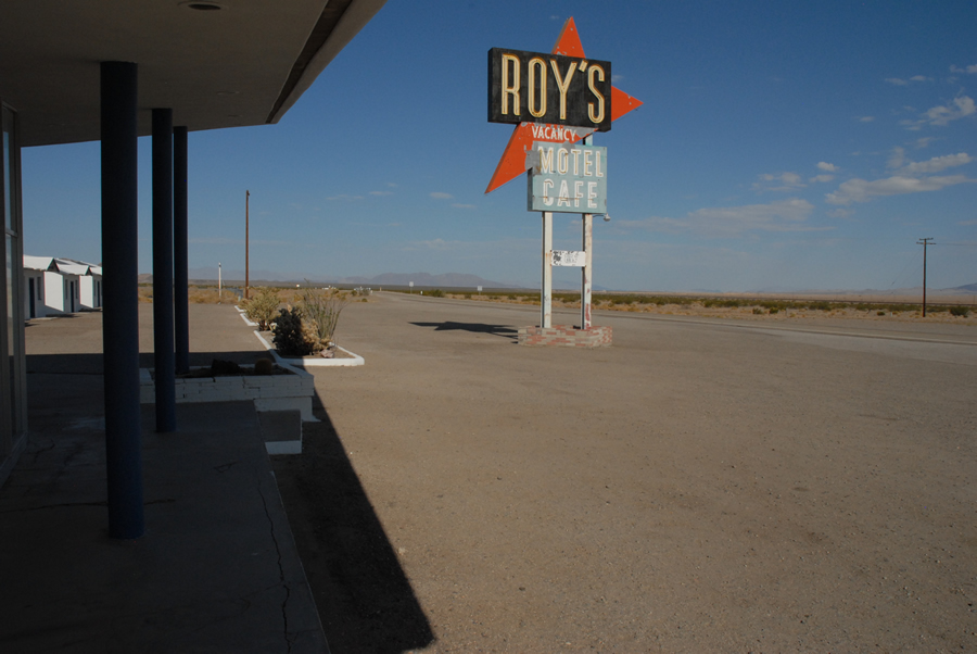
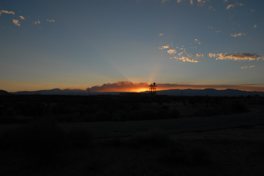
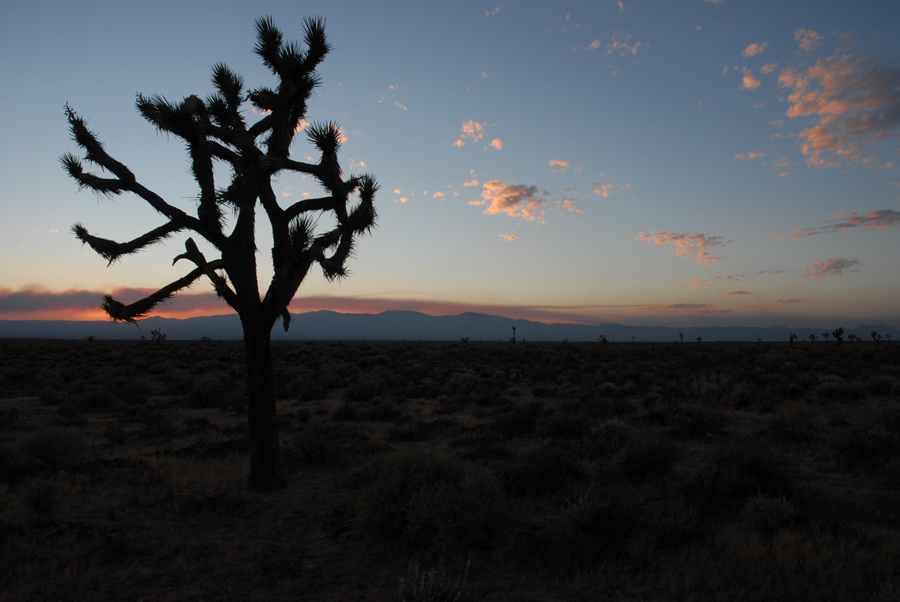
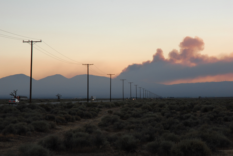
head towards Livermore via Amboy and Tehachapi. somehow over-conscious about this being a road-trip as I follow former pathways, familiar, horizons both distant and near are recognized at many various moments, rocketing down the defense inter-state. and the emblem of Route 66 stenciled on that pathway between Needles and Ludlow. the once-abandoned Roy’s gas station and motel in Amboy now a neo-post-modern stop-over, huh? and seeing a few monuments to the patriotic dead along the way. and finally, closing in on Tehachapi near sunset, a major fire happening in heavy wind immediately south of town in rugged hills not two miles from where I camp for the night in Tehachapi Mountain Park. hardly anyone around, surprisingly enough. the road in is steep as are the individual campsite slots. I set out a bed on a tarp on the powdered and dusty ground. nose is aware of fire all night, it Lights dreams, though the wind is carrying the force of the blaze to the north away, away, towards Death Valley. houses burn.
meditating on the next video work. memory: moment-by-moment. dissipation of memory in time, re-production and re-collection, re-presentation. decremented sampling of single events. focusing on the crucial, the re-membered seconds.
while raging wildfires sweep through the human-adjusted environment. is it all too late?

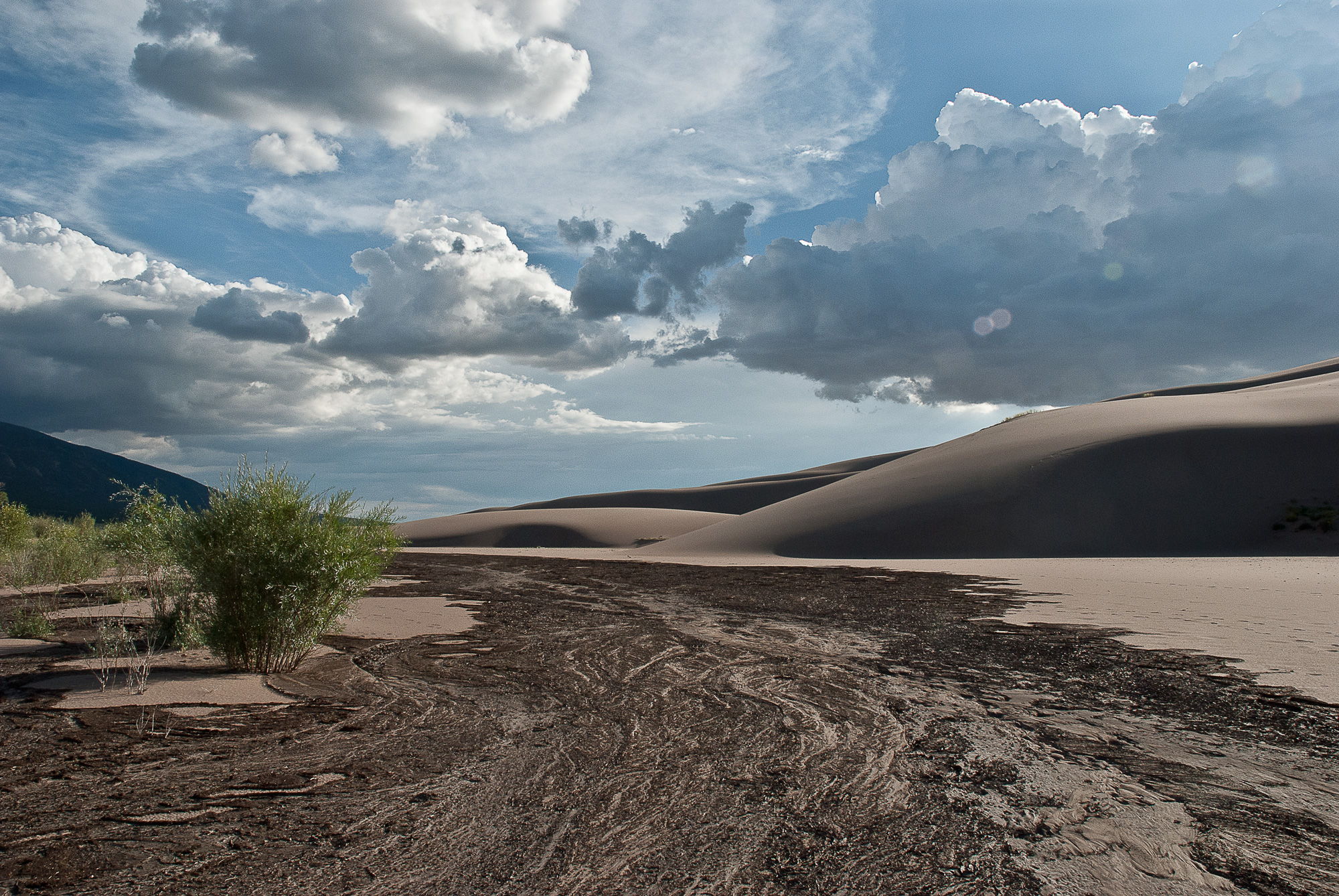
A hike in the Granite Mountain Wilderness area with Uncle Al. We spot a horned toad, lizards; the cholla and prickly-pear cactus are in bloom. The air is hazy with the wildfires near Baghdad. High winds keep the air cool on the skin, though the sun is intense. I dress with my typical sun-protection: a baseball cap with a bandana under it, bandana hung rampant over the back of my neck and over my ears to protect from the radiation. Piñon pines, Arizona thistle, many other plants that I don’t know the names of. Granite underneath it all, an eroded batholith. Hard angular fragments of pink feldspar and white quartz, sandy soil. Black magnetite in the creek beds tells of gold, but there is not much, if any, left to Lighten the money-lust of the eye.

